


Click Image to Enlarge
Kentucky Counties
Kentucky has one hundred and twenty counties, third in the US behind Texas's (254) and Georgia's (159.) Washington County was the first county formed in the Commonwealth of Kentucky when it reached statehood, and the sixteenth county formedBell County, Kentucky
Bell County Education, Geography, and History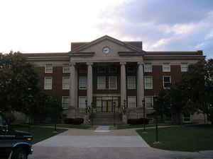
Bell County is a county located in the state of Kentucky. Based on the 2010 census, the
population was 28,691. The county
seat is
Pineville. Bell county was created August 1, 1867. The county is
named for Joshua Fry Bell, and was originally called "Josh Bell" but shortened to "Bell" by 1880.
The Middlesborough, KY Micropolitan Statistical Area includes all of Bell County.
Etymology - Origin of Bell County Name
The county is named for Joshua Fry Bell (1811-1870), Danville lawyer, congressman, and Kentucky legislator.
Demographics:
County QuickFacts: CensusBureau Quick Facts
Bell County History
Bell county was formed in 1867. It is located in the Eastern Coal Field region of the state. The elevation in the county ranges from 975 to 3500 feet above sea level. In 2000 the county population was 30,060 in a land area of 360.77 square miles, an average of 83.3 people per square mile. The county seat is Pineville. The Cumberland Gap is in Bell county, just south of Middlesborough, on the border between Kentucky and Tennessee.
The courthouse has been thrice destroyed. In 1914 and 1918 it was destroyed by fire and in 1976 through flood. The documents stored there were destroyed as well.
Bell County is considered a "limited" county, a special type of dry county, by the Kentucky Department of Alcoholic Beverage Control (ABC). In a standard dry county, all sales of alcoholic beverages are prohibited. Under ABC terminology, a limited county is an otherwise dry county in which at least one city has approved the sale of alcohol by the drink at restaurants that both seat a state-mandated number of diners and derive no more than 30% of their revenue from alcoholic beverages. In the case of Bell County, Pineville has voted to allow alcohol by the drink in restaurants that seat at least 100 diners.
Geography: Land and Water
As reported by the Census Bureau, the county has a total area of 361 square miles (930 km2), of which 359 square miles (930 km2) is land and 2.1 square miles (5.4 km2) (0.6%) is water.
Bell county is located in southeast Kentucky. Part of Cumberland Gap National Historical Park is located in this county. The county is made up mostly by two mountain ridges, Pine Mountain and Cumberland Mountain. A great deal of its rugged terrain is heavily forested with scenic streams slicing through deep valleys.
Neighboring Counties
Bordering counties are as follows:
- North: Clay County
- Northeast: Leslie County; Harlan County
- East: Lee County, Va.
- South: Claiborne County, Tenn.
- West: Whitley County
- Northwest: Knox County
Education
Three public school districts operate in the county:


Click Image to Enlarge
