


Click Image to Enlarge
Kentucky Counties
Kentucky has one hundred and twenty counties, third in the US behind Texas's (254) and Georgia's (159.) Washington County was the first county formed in the Commonwealth of Kentucky when it reached statehood, and the sixteenth county formedDaviess County, Kentucky
Daviess County Education, Geography, and History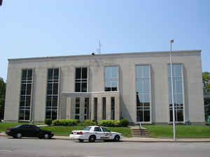
Daviess County, is a county in the state of Kentucky. Based on the 2010 census, the
population was 96,656. The county was created
from part of Ohio County on January 14, 1815. The county
seat is Owensboro. Daviess county is named
for Colonel Abraham Owen, killed at the Battle of Tippecanoe.
Daviess County is included in the Owensboro, KY Metropolitan Statistical Area.
Etymology - Origin of Daviess County Name
Daviess county is named for Colonel Joseph Hamilton Daviess (1774-1811), United States Attorney who prosecuted Aaron Burr in 1806.
Demographics:
County QuickFacts: CensusBureau Quick Facts
Daviess County History
Daviess county was formed in 1815. It is located in the Western Coal Field region of the state. The elevation in the county ranges from 347 to 680 feet above sea level. In 2000 the county population was 91,545 in a land area of 462.39 square miles, an average of 198.0 people per square mile. The county seat is Owensboro.
The courthouse burned in January 1865 during the American Civil War, but because the county records had been transferred to a church they were spared destruction.
Geography: Land and Water
As reported by the Census Bureau, the county has a total area of 477 square miles (1,240 km2), of which 458 square miles (1,190 km2) is land and 18 square miles (47 km2) (3.8%) is water.
Daviess county is located in west Kentucky. The northern half of the county along the Ohio River is somewhat flat, with a few rolling hills marking the landscape. The southern portion is mostly rolling hills mixed with flat valleys. The southern portion was mined for coal in the past, mainly in the rolling hills along Panther Creek and other streams.
Neighboring Counties
Bordering counties are as follows:
- North: Spencer County, Ind.
- Northeast: Hancock County
- Southeast: Ohio County
- Southwest: McLean County
- West: Henderson County
- Northwest: Warrick County, Ind.
Education


Click Image to Enlarge
