


Click Image to Enlarge
Kentucky Counties
Kentucky has one hundred and twenty counties, third in the US behind Texas's (254) and Georgia's (159.) Washington County was the first county formed in the Commonwealth of Kentucky when it reached statehood, and the sixteenth county formedHarrison County, Kentucky
Harrison County Education, Geography, and History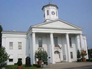
Harrison County is a county located in the state of Kentucky. Based on the 2010 census, the population was 18,846. Harrison County was created on December 21, 1793. The county seat is Cynthiana. Harrison county is named for Colonel Benjamin Harrison, an advocate for Kentucky statehood, framer of the Kentucky Constitution, and Kentucky legislator.
Etymology - Origin of Harrison County Name
Harrison county is named for Colonel Benjamin Harrison (1745-1808), advocate for Kentucky statehood, framer of the Kentucky constitution and Kentucky legislator.
Demographics:
County QuickFacts: CensusBureau Quick Facts
Harrison County History
Harrison County was formed on December 21, 1793 from portions of Bourbon and Scott Counties. Harrison was the 17th Kentucky county in order of formation.
On June 11-12, 1864 the Civil War Second Battle of Cynthiana was fought near Keller's Bridge and the later site of Battle Grove Cemetery. On the first day, Confederate General John Hunt Morgan and his 1,200 Kentucky cavalrymen captured the town, making prisoners of its Union garrison and the entire 171st Ohio Infantry Regiment. Despite being low on ammunition, Morgan chose to stay and fight the enemy forces he knew were on their way. Union General Stephen G. Burbridge and his 2,400 cavalry and mounted infantry attacked him the next morning, driving the outnumbered Confederates from the town and freeing the prisoners.
Geography
As reported by the Census Bureau, the county has a total area of 310 square miles (800 km2), of which 306 square miles (790 km2) is land and 3.5 square miles (9.1 km2) (1.1%) is water.
Harrison county is located in northeast Kentucky. This county is located in the Bluegrass region of the state. The elevation in the county ranges from 540 to 1060 feet above sea level.
Neighboring Counties
Bordering counties are as follows:
- North: Pendleton County
- Northeast: Bracken County; Robertson County
- Southeast: Nicholas County; Bourbon County
- Southwest: Scott County
- Northwest: Grant County
Education

County Resources:
Enter County Resources and Information Here

Click Image to Enlarge
