


Click Image to Enlarge
Kentucky Counties
Kentucky has one hundred and twenty counties, third in the US behind Texas's (254) and Georgia's (159.) Washington County was the first county formed in the Commonwealth of Kentucky when it reached statehood, and the sixteenth county formedHart County, Kentucky
Hart County Education, Geography, and History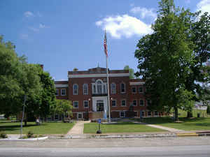
Hart County is a county located in the Commonwealth of Kentucky. Based on the 2010 census, the population was 18,199. Hart County was created on January 28, 1819. The county seat is Munfordville. The county is named for Captain Nathaniel G. S. Hart, a Kentucky militia officer in the War of 1812 who was wounded at the Battle of Frenchtown and died in the Massacre of the River Raisin.
Etymology - Origin of Hart County Name
Hart county is named for Captain Nathaniel G.T. Hart (1784-1813), Lexington lawyer and merchant and an officer in the War of 1812. Captain Hart was one of those honored after the Battle of River Raisin.
Demographics:
County QuickFacts: CensusBureau Quick Facts
Hart County History
Hart County was formed in 1819 from portions of Hardin and Barren counties. It is located in the Pennyrile region of the state. The elevation in the county ranges from 421 to 1156 feet above sea level. In 2000 the county population was 17,445 in a land area of 415.93 square miles, an average of 41.9 people per square mile. The county seat is Munfordville.
The Battle of Munfordville, a Confederate victory, was fought in the county in 1862, during the American Civil War.
A courthouse fire in January, 1928 resulted in the loss of some county records.
Hart County is a prohibition or dry county.
Geography: Land and Water
As reported by the Census Bureau, the county has a total area of 418 square miles (1,080 km2), of which 412 square miles (1,070 km2) is land and 5.8 square miles (15 km2) (1.4%) is water.
Hart county is located close to the center of Kentucky. Nolin River and Lake form the western boundary of the county, while Green River winds through the center, flowing east to west.
Neighboring Counties
Bordering counties are as follows:
- North: Hardin County
- Northeast: Larue County
- East: Green County
- Southeast: Metcalfe County
- South: Barren County
- Southwest: Edmonson County
- Northwest: Grayson County
Education


Click Image to Enlarge
