


Click Image to Enlarge
Kentucky Counties
Kentucky has one hundred and twenty counties, third in the US behind Texas's (254) and Georgia's (159.) Washington County was the first county formed in the Commonwealth of Kentucky when it reached statehood, and the sixteenth county formedKenton County, Kentucky
Kenton County Education, Geography, and History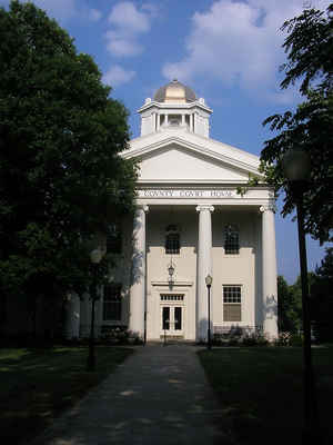
Kenton County is a county located in the Commonwealth of Kentucky. Based on the 2010 census, the
population was 159,720. Kenton County was
created on January 29, 1840. The county
seats are Covington and Independence. This county was, until
November 24, 2010, the only county in Kentucky to have two legally recognized county seats.
Kenton county is named for
Simon Kenton, a frontiersman notable in the early history of the state.
Kenton County is included in the Cincinnati-Middletown, OH-KY-IN Metropolitan Statistical Area.
Etymology - Origin of Kenton County Name
Kenton county is named for Simon Kenton (1755-1836), Kentucky pioneer, scout, and Indian fighter.
Demographics:
County QuickFacts: CensusBureau Quick Facts
Kenton County History
Kenton county was formed in 1840. It is located in the Outer Bluegrass region of the state. In 2000 the county population was 151,464 in a land area of 161.97 square miles, an average of 935.1 people per square mile. Kenton county is the third most populous county in Kentucky (behind Jefferson County and Fayette County).The county seats are Covington and Independence. Kenton county is in the northern Kentucky area.
Geography: Land and Water
As reported by the Census Bureau, the county has a total area of 164 square miles (420 km2), of which 160 square miles (410 km2) is land and 4.1 square miles (11 km2) (2.5%) is water. The elevation in the county ranges from 455 to 960 feet above sea level.
Kenton county is located in north Kentucky. The county is located at the meeting of the Licking River and Ohio River, in the outer Bluegrass area of the Bluegrass region of the state.
Neighboring Counties
Bordering counties are as follows:
- North: Hamilton County, Ohio
- East: Campbell County
- Southeast: Pendleton County
- South: Grant County
- Northwest: Boone County
Education
Public schools
The public education in Kenton County is extensive, with five school districts providing education to those in all parts of Kenton County,
including the extremely southern rural areas and the highly urbanized north. The districts are:
The Kenton County School District
Covington Independent Public Schools
Beechwood Independent School District (serves Fort Mitchell)
Ludlow Independent Schools
Erlanger-Elsmere Schools
Private schools
The Catholic educational system is as extensive as the public system. These schools are operated by the Diocese of Covington's Department of Schools. The Diocese runs 17 schools in Kenton County.
Higher education
Thomas More College is the only institute of higher learning wholly in the county itself. Northern Kentucky University had a Covington campus located at 1401 Dixie Highway until it closed at the end of 2008. NKU's main campus is not far from Kenton County - only about 4 miles from the Licking River. The Kentucky Community and Technical College System also operates the Gateway Community and Technical College. Classes are provided at GCTC locations in Boone County, Covington, Park Hills and Edgewood.


Click Image to Enlarge
