


Click Image to Enlarge
Kentucky Counties
Kentucky has one hundred and twenty counties, third in the US behind Texas's (254) and Georgia's (159.) Washington County was the first county formed in the Commonwealth of Kentucky when it reached statehood, and the sixteenth county formedLogan County, Kentucky
Logan County Education, Geography, and History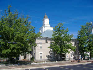
Logan County is a county located in the southwest Pennyroyal area of the state of Kentucky. Based on the 2010 census, the population was 26,835. Logan County was created on September 1, 1792. The county seat is Russellville. Logan county is named for General Benjamin Logan.
Etymology - Origin of Logan County Name
Logan county is named for General Benjamin Logan (1743-1802), soldier, sheriff, Indian fighter, and advocate for Kentucky's statehood in the Virginia legislature.
Demographics:
County QuickFacts: CensusBureau Quick Facts
Logan County History
Created from Lincoln on September 1, 1792, Logan was the 13th Kentucky county in order of formation. Originally, its territory stretched from the Mississippi in the west to the Little Barren River in the east and from the Green and Ohio Rivers in the north to the Tennessee border on the south; since then, 28 other counties have been formed within that area. The settlement of Logan Court House was made the county seat at its incorporation under the name Russellville.
It is located in the Pennyrile and Western Coal Field regions of the state. In 2000 the county population was 26,573 in a land area of 555.68 square miles, an average of 47.8 people per square mile. The county seat is Russellville.
Geography: Land and Water
As reported by the Census Bureau, the county has a total area of 557 square miles (1,440 km2), of which 552 square miles (1,430 km2) is land and 4.9 square miles (13 km2) (0.9%) is water.
Logan county is located in southwest Kentucky. Lake Malone State Park is in this county. The elevation in the county ranges from 395 to 868 feet above sea level.
Neighboring Counties
Bordering counties are as follows:
- Northeast: Butler County; Warren County
- Southeast: Simpson County
- South: Robertson County, Tenn.
- West: Todd County
- Northwest: Muhlenberg County
Education
Daymar College


Click Image to Enlarge
