


Click Image to Enlarge
Kentucky Counties
Kentucky has one hundred and twenty counties, third in the US behind Texas's (254) and Georgia's (159.) Washington County was the first county formed in the Commonwealth of Kentucky when it reached statehood, and the sixteenth county formedMercer County, Kentucky
Mercer County Education, Geography, and History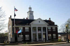
Mercer County is a county located in the state of Kentucky. Based on the 2010 census, the population was 21,331. Mercer County was created on December 15, 1785. The county seat is Harrodsburg. The county is named for Revolutionary War General Hugh Mercer, who was killed at the Battle of Princeton in 1777.
Etymology - Origin of Mercer County Name
Mercer county is named or Revolutionary War General Hugh Mercer (1725-1777), who was killed at the Battle for Princeton in 1777.
Demographics:
County QuickFacts: CensusBureau Quick Facts
Mercer County History
Harrodsburg was the first city formally chartered in Kentucky County, the Virginia territory that later became the 15th American state. It was originally the county seat of Lincoln County when it was formed in 1780, but it became the seat of Mercer County when it was created.
The American Civil War divided the county. The Union Army's 19th Regiment Kentucky Volunteer Infantry was organized at Camp Harwood in Harrodsburg, and was mustered in for a three-year enlistment on January 2, 1862 under the command of Colonel William J. Landram. However, many other county men served in the Confederate Army.
In 2000 the county population was 20,817 in a land area of 250.92 square miles, an average of 83.0 people per square mile. The county seat is Harrodsburg.
Geography: Land and Water
As reported by the Census Bureau, the county has a total area of 253 square miles (660 km2), of which 249 square miles (640 km2) is land and 4.5 square miles (12 km2) (1.8%) is water.
Mercer county is located close to the center of Kentucky. This county is located in the Bluegrass region of the state. Herrington Lake is located in this county. The elevation in the county ranges from 483 to 1000 feet above sea level.
Neighboring Counties
Bordering counties are as follows:
- Northeast: Woodford County; Jessamine County
- Southeast: Garrard County
- South: Boyle County
- West: Washington County
- Northwest: Anderson County
Education


Click Image to Enlarge
