


Click Image to Enlarge
Kentucky Counties
Kentucky has one hundred and twenty counties, third in the US behind Texas's (254) and Georgia's (159.) Washington County was the first county formed in the Commonwealth of Kentucky when it reached statehood, and the sixteenth county formedMonroe County, Kentucky
Monroe County Education, Geography, and History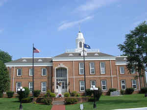
Monroe County is a county located in the state of Kentucky. Based on the 2010 census, the population was 10,963. Monroe County was created January 19, 1820. The county seat is Tompkinsville. The county is named for President James Monroe.
Etymology - Origin of Monroe County Name
James Monroe (1758-1831), president of the United States who issued an important contribution to US foreign policy in the Monroe Doctrine, a warning to European nations against intervening in the Western Hemisphere.
Demographics:
County QuickFacts: Census Bureau Quick Facts
Monroe County History
Monroe County is the only county of the 2,957 in the United States named for a President where the county seat is named for his Vice-President. The county was formed in 1820; and named for James Monroe the fifth President, author of the Monroe Doctrine. The county seat was named for Daniel Tompkins. They both served from 1817 to 1825.
Monroe county is located in the Pennyrile region of the state.
Confederate General John Hunt Morgan's first Kentucky raid occurred here on July 9, 1862. Morgan's Raiders, coming from Tennessee, attacked Major Thomas J. Jordan's 9th Pennsylvania Cavalry at USA garrison. Raiders captured 30 of retreating enemy and destroyed tents and stores. They took 20 wagons, 50 mules, 40 horses, sugar and coffee supplies. At Glasgow they burned supplies, then went north, raiding 16 other towns before returning to Tennessee. The county is a prohibition or dry county.
In 2000 the county population was 11,756 in a land area of 330.81 square miles, an average of 35.5 people per square mile. The county seat is Tompkinsville.
Geography: Land and Water
As reported by the Census Bureau, the county has a total area of 332 square miles (860 km2), of which 329 square miles (850 km2) is land and 2.7 square miles (7.0 km2) (0.8%) is water. The elevation in the county ranges from 495 to 1141 feet above sea level.
Monroe county is located close to the center of Kentucky. The Upper Cumberland hills, the Cumberland River, the headwaters of the Barren River are located in this county.
Neighboring Counties
Bordering counties are as follows:
- Northeast: Metcalfe County; Cumberland County
- Southeast: Clay County, Tenn.
- Southwest: Macon County, Tenn.
- West: Allen County
- Northwest: Barren County
Education


Click Image to Enlarge
