


Click Image to Enlarge
Kentucky Counties
Kentucky has one hundred and twenty counties, third in the US behind Texas's (254) and Georgia's (159.) Washington County was the first county formed in the Commonwealth of Kentucky when it reached statehood, and the sixteenth county formedTodd County, Kentucky
Todd County Education, Geography, and History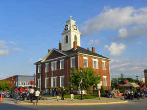
Todd County is a county located in the state of Kentucky. Based on the 2010 census, the population was 12,460. The county was founded in 1820. The county seat is Elkton. Todd county is named for Colonel John Todd, who was killed at the Battle of Blue Licks in 1782 during the American Revolution.
Etymology - Origin of County Name
Colonal John Todd (1750-1782), Indian fighter who served with George Rogers Clark in Illinois.
Demographics:
County QuickFacts: CensusBureau Quick Facts
County History
Portions of Christian and Logan counties were taken to organize Todd County. Their more distant populations had demanded "home government," as travel to the county seats of Logan and Christian was arduous. The county was formed in 1820 by the first magisterial court, consisting of members Edward Shanklin, Major John Gray, Robert Coleman, Henry Gorin, John Taylor, H. C. Ewing, John S Anderson, William Hopper, John Mann and Joseph Frazer. The petition was created and the legislature of the Commonwealth of Kentucky granted the act of legislature, enacting the creation of the county on April 1, 1820.
This county is located in the Pennyrile region of the state. In 2000 the county population was 11,971 in a land area of 376.35 square miles, an average of 31.8 people per square mile. The county seat is Elkton.
Geography: Land and Water
As reported by the Census Bureau, the county has a total area of 377 square miles (980 km2), of which 374 square miles (970 km2) is land and 2.6 square miles (6.7 km2) (0.7%) is water. The elevation in the county ranges from 405 to 966 feet above sea level.
Todd county is located in west Kentucky. Todd County consists
of two geographical regions known in history as the high country to the
north and low country to the south. The northern highlands are made up
of steep-sloped sandstone terrain. The landscape contains steep bluffs.
The southern lowlands consist of rolling limestone flatlands. Lake
Malone is located in this county.
Neighboring Counties
Bordering counties are as follows:
- North: Muhlenberg County
- East: Logan County
- Southeast: Robertson County, Tenn.
- Southwest: Montgomery County, Tenn.
- West: Christian County
Education


Click Image to Enlarge
