


Click Image to Enlarge
Kentucky Counties
Kentucky has one hundred and twenty counties, third in the US behind Texas's (254) and Georgia's (159.) Washington County was the first county formed in the Commonwealth of Kentucky when it reached statehood, and the sixteenth county formedWhitley County, Kentucky
Whitley County Education, Geography, and History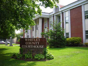
Whitley County is a county situated in the state of Kentucky. Based on the 2010 census, the
population was 35,637. The county was created
on January 17, 1818. The county seat is at
Williamsburg. The county is named for Colonel William
Whitley.
Whitley County is included in the London, KY Micropolitan Statistical Area
Etymology - Origin of Whitley County Name
The namesake of the county, Colonel William Whitley, is famous locally for fighting many of these battles within the area, safeguarding the Wilderness Road, as well as for his service in the War of 1812, where he was killed at the Battle of the Thames. The county seat, Williamsburg, is also named for Colonel Whitley, with the first court held at the home of the town's earliest resident, Samuel Cox
Demographics:
County QuickFacts: CensusBureau Quick Facts
Whitley County History
Whitley County was created on January 17, 1818 from adjacent Knox County, Kentucky. In the years prior to its establishment as an independent county, many skirmishes were fought between native Indians and hunters and trappers in the area. The county is located in the Eastern Coal Field region of the state. In 2000 the county population was 35,865 in a land area of 440.15 square miles, an average of 81.5 people per square mile. The county seat is Williamsburg.
Geography: Land and Water
As reported by the Census Bureau, the county has a total area of 445 square miles (1,150 km2), of which 438 square miles (1,130 km2) is
land and 7.3 square miles (19 km2) (1.6%) is water. The
elevation in the county ranges from 723 to 2220 feet above sea level.
Whitley County is located in southeastern Kentucky within the
Cumberland Plateau , which is greatly overlapped by the broad Eastern
Coal Field region of the state. The Daniel Boone National Forest is
located in this county.
Cumberland Falls is the largest waterfall in Kentucky. Two
locally important waterways wind through the county, the Laurel and Cumberland river.
Neighboring Counties
Bordering counties are as follows:
- North: Laurel County
- Northeast: Knox County
- East: Bell County
- Southeast: Claiborne County, Tenn.
- South: Campbell County, Tenn.
- West: McCreary County
Education
K-12
Three public school districts serve the county:
Whitley County School District
Williamsburg Independent School District
Corbin Independent School District
Colleges and universities
The University of the Cumberlands (formerly known as Cumberland College), located in Williamsburg, is the largest private university in Kentucky, and the only university with its main campus in Whitley County. The school's sports teams play on the NAIA level and provide college level sporting events for the local community. In addition, Eastern Kentucky University maintains a branch campus in the Whitley County portion of Corbin.


Click Image to Enlarge
