

Click Image to Enlarge
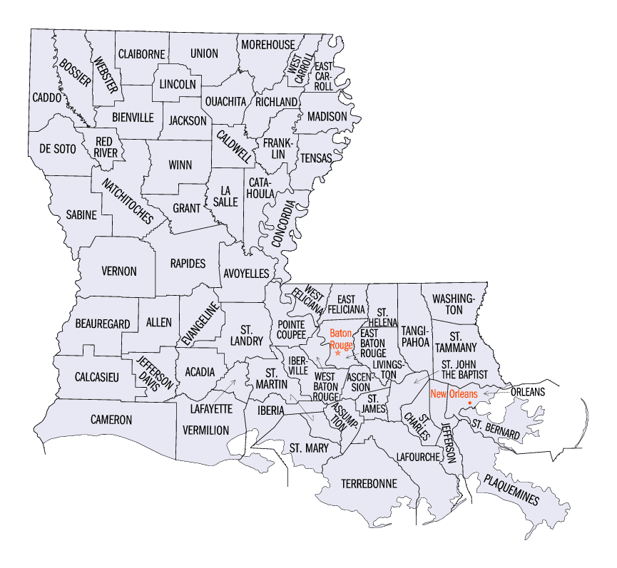
Louisiana Parishes
Louisiana is divided into sixty-four parishes. On March 31, 1807, the territorial legislature divided the state into 19 parishes, without getting rid of the old counties (which continued to exist until 1845). In 1811, a constitutional convention organized the state into seven judicial districts, each consisting of groups of parishes. In 1816, the first official map of the state used the term, as did the 1845 constitution. Since then, the official term has been parishes.St. Bernard Parish, Louisiana
St. Bernard Parish Education, Geography, and History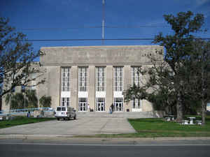
St. Bernard Parish is a parish located in the state of Louisiana. Based on the 2010 census, the population was 35,897. The parish seat
and largest city is Chalmette. The parish was formed in 1807.
St. Bernard Parish is part of the New Orleans-Metairie, LA Metropolitan Statistical Area. The parish is located southeast of New Orleans. It
has been ranked the fastest-growing county (parish) in the United States from 2007 to 2008 by the US Census Bureau, but it is only half as
populated as it was in 2005. In 2009, because of evacuation and outmigration due to destruction by Hurricane Katrina, its population was
estimated to be 33,439
Etymology - Origin of St. Bernard Parish Name
The parish was named in honor of Saint Bernard; presumably the patron saint of Bernardo de Galvez who granted land to the Canary Islanders who settled the area in 1778 while Louisiana was under Spanish rule. The Parish was previously named Terre-aux-Bouef, "Land of Oxen" because of large herds of bison that once inhabited the area.
Demographics:
County QuickFacts: CensusBureau Quick Facts
St. Bernard County History
St. Bernard Parish was created on March 31, 1807. It is one of the 19 parishes, which were created by dividing the Territory of New Orleans. The parish was named in honor of Saint Bernard; presumably the patron saint of Bernardo de Galvez who granted land to the Canary Islanders who settled the area in 1778 while Louisiana was under Spanish rule. The Parish was previously named Terre-aux-Bouef, "Land of Oxen" because of large herds of bison that once inhabited the area . The Parish seat is Chalmette.
Geography: Land and Water
As reported by the Census Bureau, the parish has a total area of 2,158 square miles (5,590 km2), of which 378 square miles (980 km2) is
land and 1,781 square miles (4,610 km2) (83%) is water. It is the second largest parish in Louisiana by total area and has the largest
percentage of area in water of any parish.
The parish of St. Bernard embraces numerous small islands. The parish is classed among the alluvial lands of the state. The ridges comprise
the arable lands of the parish and have an area of 37,000 acres (150 km2). The principal streams are the Bayous Terre aux Boeufs and La Loutre.
There are numerous smaller streams which are efficient drainage canals. The dominant tree species is bald cypress, of which the most valuable
trees have been cut and processed.
Neighboring Parishes
Bordering parishes and counties are as follows:
- North: Lake Borgne
- Southeast: Gulf of Mexico
- South: Plaquemines Parish
- Northwest: Orleans Parish
Education
Public schools in the parish are operated by the St. Bernard Parish Public Schools agency.
The parish is served by Nunez Community College.


Click Image to Enlarge
