

Click Image to Enlarge
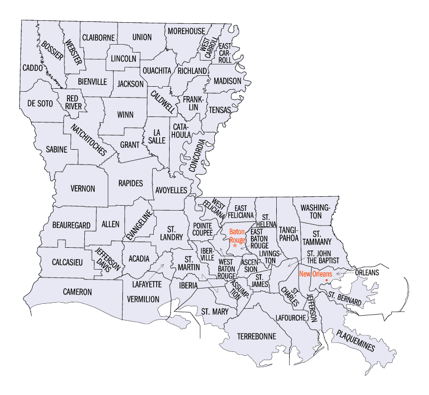
Louisiana Parishes
Louisiana is divided into sixty-four parishes. On March 31, 1807, the territorial legislature divided the state into 19 parishes, without getting rid of the old counties (which continued to exist until 1845). In 1811, a constitutional convention organized the state into seven judicial districts, each consisting of groups of parishes. In 1816, the first official map of the state used the term, as did the 1845 constitution. Since then, the official term has been parishes.West Baton Rouge Parish, Louisiana
West Baton Rouge Parish Education, Geography, and History
West Baton Rouge Parish is one of the sixty-four parishes in the state of Louisiana. Based on the 2010 census, the population was 23,788.
The parish seat is Port Allen. The parish was created in 1807.
West Baton Rouge Parish is part of the Baton Rouge, LA Metropolitan Statistical Area.
Etymology - Origin of West Baton Rouge Parish Name
The parish was named in honor of the French phrase b?on rouge meaning red stick. A red stick was used by local Native Americans to mark the boundaries between tribal territories.
Demographics:
County QuickFacts: CensusBureau Quick Facts
West Baton Rouge County History
Baton Rouge Parish was created in 1792 in the West Floridas area. The land was divided into E. & W. Baton Rouge Parishes in 1810. West Baton Rouge Parish was created on 1810, from Baton Rouge Parish and the parish was named in honor of the French phrase b?on rouge meaning red stick. A red stick was used by local Native Americans to mark the boundaries between tribal territories. The Parish seat is Port Allen.
Geography: Land and Water
As reported by the Census Bureau, the parish has a total area of 204 square miles (530 km2), of which 192 square miles (500 km2) is land
and 11 square miles (28 km2) (5.6%) is water. It is the second-smallest parish in Louisiana by land area and smallest by total area.
The southwestern portion of the parish is uninhabited timberland. The most prominent geographic feature is the Mississippi River which forms
the east border of the parish. Levees along the river protect the parish from flooding by the Mississippi River in times of high water.
The parish is contained within the Two Rivers Region of the Atchafalaya National Heritage Area.
Neighboring Parishes
Bordering parishes and counties are as follows:
- North: West Feliciana Parish
- Northeast: East Baton Rouge Parish
- South: Iberville Parish
- Northwest: Pointe Coupee Parish
Education
West Baton Rouge Parish School Board operates area public schools.
Holy Family School is a local private Catholic school for grades pre-K through Eight


Click Image to Enlarge
