

Click Image to Enlarge
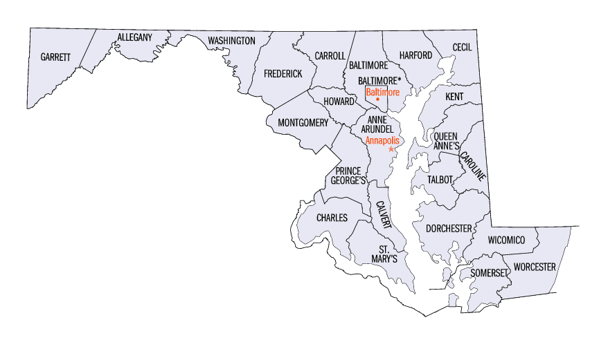
Maryland Counties
There are twenty-four counties and county-equivalents in Maryland. Though an independent city rather than a county, the City of Baltimore is considered the equal of a county. The last new county formation in Maryland occurred when Garrett County was formed in 1872 from portions of Allegany County.Calvert County, Maryland
Calvert County Education, Geography, and History
Calvert County is a county located in the state of Maryland. Based on the 2010 census, the population was 88,737. Its county seat is
Prince Frederick. The county's name is derived from the family name of the Barons of Baltimore, the proprietors of the English Colony of
Maryland.
Calvert County is included in the Washington-Arlington-Alexandria, DC-VA-MD-WV Metropolitan Statistical Area. It occupies the Calvert
Peninsula, which is bordered on the east by Chesapeake Bay and on the west by the Patuxent River.
Calvert County is part of the Southern Maryland region. The county has one of the highest median household incomes in the United States.
Etymology - Origin of Calvert County Name
The Calvert family; prior to 1658 it was called Patuxent County, after the Patuxent Indians, a branch of the Algonquians
Demographics:
County QuickFacts: CensusBureau Quick Facts
Calvert County History
First settled as part of Charles County (much larger than the present-day Charles County) around 1650, it was renamed. Patuxent County was
established in 1654 by an Order in Council. In 1658 the county was renamed Calvert County. It is one of the older counties in Maryland, after
St. Mary's County, Kent County and Anne Arundel County.
Once made up primarily of farms and tobacco fields, the county has become a fast-growing exurban neighbor of Washington. Many home prices have
nearly quadrupled in the past decade, with many four-bedroom homes in the northern half of the county averaging over $1,000,000. The popular
weekend resort towns of Solomons, Chesapeake Beach, and North Beach are notable.
Geography: Land and Water
As reported by the Census Bureau, the county has a total area of 345 square miles (890 km2), of which 213 square miles (550 km2) is land
and 132 square miles (340 km2) (38%) is water. It is the smallest county in Maryland by land area and third-smallest by total area.
Calvert County lies in the humid subtropical climate zone, with hot, humid summers and mild to chilly winters with plentiful precipitation
year-round. Its proximity to the Chesapeake Bay has a moderating effect on temperatures compared with locales further inland.
Neighboring Counties
Bordering counties are as follows:
- North: Anne Arundel County
- East: Chesapeake Bay
- South: St. Mary's County
- West: Charles County
- Northwest: Prince George's County
Education
Calvert County is served by Calvert County Public Schools. The county's education system consists of 13 elementary schools, six middle schools, four high schools, vocational education center, and a variety of other facilities.


Click Image to Enlarge
