

Click Image to Enlarge
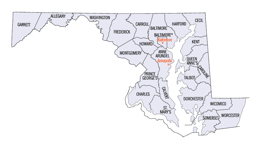
Maryland Counties
There are twenty-four counties and county-equivalents in Maryland. Though an independent city rather than a county, the City of Baltimore is considered the equal of a county. The last new county formation in Maryland occurred when Garrett County was formed in 1872 from portions of Allegany County.Worcester County, Maryland
Worcester County Education, Geography, and History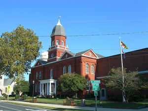
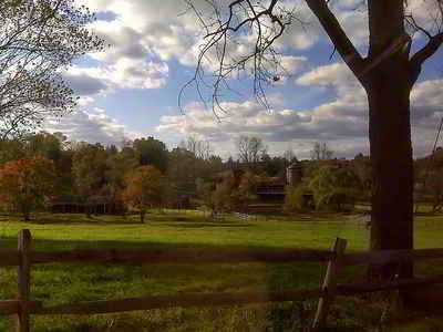
Worcester County is the easternmost county of the state of Maryland. Based on the 2010 census, the population was 51,454. Its county seat is
Snow Hill. The county was named for Mary Arundell, the wife of Sir John Somerset, a son of Henry Somerset, 1st Marquess of Worcester. She was sister
to Anne Arundell (Anne Arundell County), wife of Cecil Calvert, 2nd Baron Baltimore, the first Proprietor and Proprietary Governor of the Province
of Maryland.
Worcester County is included in the Salisbury, MD-DE Metropolitan Statistical Area.
Etymology - Origin of Worcester County Name
Mary Arundell, the wife of Sir John Somerset, son of the 1st Marquess of Worcester, and sister of Anne Arundell, wife of Cecilius Calvert , 2nd Baron Baltimore
Demographics:
County QuickFacts: CensusBureau Quick Facts
Worcester County History
Worcester County was created by the division of the formerly larger Eastern Shore's Somerset County in 1742. The
county seat, which was previously located near the confluence of Dividing Creek with the Pocomoke River, was later transferred to the river port of
Snow Hill, at the head of navigation of the Pocomoke, now near the center of the new county.
Both the areas of Somerset and Worcester Counties were divided into old colonial divisions of "hundreds", from south to north: Mattapony, Pocomoke,
Boquetenorton, Wicomico, and Baltimore Hundreds. Later subdivisions of these hundreds added Pitts Creek, Acquango, Queponco, and Buckingham &
Worcester Hundreds, all of which in turn eventually became election districts for the newly independent state following American independence.
Competing territorial claims between the Proprietor family of the Calverts and the Lords Baltimore in the old Province of Maryland and the Penns of
the neighboring Province of Pennsylvania to the north and of what later became the state of Delaware to the east led to the surveying of Worcester
County's northern border, the "Transpeninsular Line" in 1751, though boundary disputes continued through the rest of the colonial period, not
totally settled until the work of the famous Charles Mason and Jeremiah Dixon with their "Mason-Dixon line". In 1779, Stephen Decatur, the famous
United States Navy officer and hero of the First Barbary War and the Second Barbary War in the early 1800s, and leading into the War of 1812, was
born at Sinepuxent, near what is today the town of Berlin.
Geography: Land and Water
As reported by the Census Bureau, the county has a total area of 695 square miles (1,800 km2), of which 468 square miles (1,210 km2) is land
and 227 square miles (590 km2) (33%) is water. It is the third-largest county in Maryland by total area.
The terrain is mostly level and coastal. The lowest elevation is sea level along the Atlantic Ocean and the highest elevation is 49 ft (15 m) in the
northwestern part of the county along State Route 12 just south of the Wicomico County line.
Neighboring Counties
Bordering counties are as follows:
- North: Sussex County, Del.
- East: North Atlantic Ocean
- South: Accomack County, Va.
- West: Somerset County
- Northwest: Wicomico County
Education


Click Image to Enlarge
