

Click Image to Enlarge
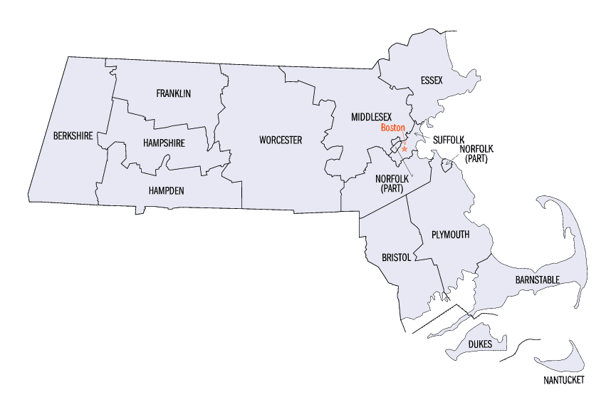
Massachusetts Counties
Massachusetts consists of the fourteen counties. Massachusetts has abolished seven of its fourteen county governments, leaving five Counties with county-level local government (Barnstable, Bristol, Dukes, Norfolk, Plymouth) and two, Nantucket County and Suffolk County, with combined county/city government. The oldest counties still in Massachusetts are Essex County, Middlesex County, and Suffolk County, created in 1643 with the original Norfolk County which was absorbed by New Hampshire and bears no relation to the modern Norfolk County.Nantucket County, Massachusetts
Nantucket County Education, Geography, and History
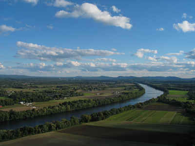
Nantucket is an island 30 miles (50 km) south of Cape Cod, in the American state of Massachusetts. Together with the small islands of Tuckernuck and Muskeget, it constitutes the Town of Nantucket, and the coterminous Nantucket County, which are consolidated. Based on the 2010 census, the population was 10,172, making it the least-populous county in Massachusetts. Part of the town is designated the Nantucket CDP, or census-designated place. The region of Surfside on Nantucket is the southernmost settlement in Massachusetts.
Etymology - Origin of Nantucket County Name
Also nicknamed "The Grey Lady" due to occasional intense fog, Nantucket takes its name from a word in an Eastern
Algonquian language of southern New England, originally spelled variously as natocke, nantican, and nautican. The
meaning of the term is uncertain, though it may have meant "in the midst of waters," or "far away island."
Other sources state the Native American word "Natockete," meaning "faraway land," to be Nantucket's namesake. The
Wampanoag Native Americans referred to the island as "Canopache," or "place of peace."
Demographics:
County QuickFacts: CensusBureau Quick Facts
Nantucket County History
The island's beginnings in western history can possibly be traced to its conjectured sighting by Norsemen in the 11th century. But it was not until 1602 that Captain Bartholomew Gosnold of Falmouth, England sailed his bark Concord past the bluffs of Siasconset and really put Nantucket on the map. The island's original inhabitants, the Wampanoag Indians, lived undisturbed until 1641 when the island was deeded by the English (the authorities in control of all land from the coast of Maine to New York) to Thomas Mayhew and his son, merchants of Watertown and Martha's Vineyard. Nantucket was part of Dukes County, New York until 1691, when it was transferred to the newly formed Province of Massachusetts Bay and split off to form Nantucket County. The entire area of the New York county had been purchased by Thomas Mayhew Sr. of Watertown, Massachusetts, in 1641, buying out competing land claims. The earliest English settlement in the area began on neighboring island Martha's Vineyard.
Geography: Land and Water
Nantucket was formed by the uttermost reach of the Laurentide Ice Sheet during the recent Wisconsin Glaciation,
shaped by the subsequent rise in sea level. The island's low ridge across the northern section was deposited as
glacial moraine during a period of glacial standstill, a period during which till continued to arrive, but melted at
a stationary front. The southern part of the island is an outwash plain, sloping away from the arc of moraine and
shaped at its margins by the sorting actions and transport of longshore drift. Nantucket became an island when
rising sea levels reflooded Buzzards Bay about 5000-6000 years ago.
As reported by the Census Bureau, Nantucket County has a total area of 303.5 sq mi (786 km2), 84.25% of which is
water. The area of Nantucket Island proper is 47.8 sq mi(123.8 km2). The triangular region of ocean between
Nantucket, Martha's Vineyard and Cape Cod, is Nantucket Sound. The highest point on the island is Folger Hill which
stands 109 feet (33 m) above sea level. Altar Rock is a close second at a height of 108 feet (33 m) above sea level.
The entire island, as well as the adjoining islands of Tuckernuck and Muskeget, comprise both the Town of Nantucket
and
Neighboring Counties
Bordering counties are as follows:
- Southeast: North Atlantic Ocean
- West: Muskeget Channel
- Northwest: Nantucket Sound
Education
Nantucket's public school district is Nantucket Public Schools.
Schools on the island include:
Nantucket Elementary School (Public)
Cyrus Peirce Middle School (Public)
Nantucket High School (Public)
Nantucket Community School (Public, Extracurricular)
Nantucket Lighthouse School (Private)
Nantucket New School (Private)
The University of Massachusetts Boston operates a field station on Nantucket, currently operated by Dr. Sarah Oktay. The Massachusetts College
of Art & Design is affiliated with the Nantucket Island School of Design & the Arts, which offers summer courses for teens, youth,
postgraduate, and undergraduate programs.


Click Image to Enlarge
