


Click Image to Enlarge
Michigan Counties
The boundaries of the eighty-three counties in Michigan have not changed substantially since 1897. Wayne County was the sixth county in the Northwest Territory, formed 15 August 1796 and organized in 1815. Wayne County was created 21 November 1815 as an original county of Michigan.Berrien County, Michigan
Berrien County Education, Geography, and History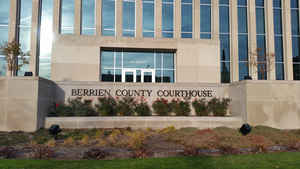
Berrien County is a county located in the extreme southwest of the state of Michigan. Based on the 2010 census, the population was
156,813. The county seat is St. Joseph.
Berrien County is included in the Niles-Benton Harbor, MI Metropolitan Statistical Area, which is also included in the South
Bend-Elkhart-Mishawaka, IN-MI Combined Statistical Area.
Etymology - Origin of Berrien County Name
Named for the Hon. John M. Berrien, Attorney General under President Andrew Jackson
Demographics:
County QuickFacts: CensusBureau Quick Facts
Berrien County History
Named for the Hon. John M. Berrien, Attorney General under President Andrew Jackson
The Cabinet counties of the US state of Michigan are those named after President Andrew Jackson and people who served in his Cabinet.
Set Off: 1829
Organized: 1831
As one of the Cabinet counties, Berrien County was named for John M. Berrien of Georgia, US Attorney General under US President Andrew
Jackson (1829-1831). The county was founded in 1829 and organized in 1831.
After creation of the Michigan Territory in 1805, the territory now comprising Berrien County was part of Wayne County, Michigan. About 1780,
William Burnett came from New Jersey and established a trading post at the mouth of the St. Joseph River (present-day site of St. Joseph), and
traded with indigenous peoples and French Canadians who lived in the area at that time. About the same time, Joseph Bertrand also established
a trading post on the river, in a location now part of Niles Charter Township. In December 1822, missionary Isaac McCoy moved his family and
18 Indian students from Indiana to a site on the St. Joseph River near the present-day city of Niles to open a mission to the Potawatomi
Indians. The Carey Mission, as he named it, was 100 miles from the nearest White settlement. In 1827 St. Joseph Township was organized as part
of Wayne County. The township included all lands acquired from the Native Americans by the Treaty of Chicago of 1821.
Berrien County's boundaries were set off by an act of the legislature of the Michigan Territory on October 29, 1829, with its present limits,
but it was initially attached as Niles Township to Cass County for administrative purposes. In 1831 Berrien County was detached from Cass
County.
The county was initially divided into three townships: Berrien Township, consisting of present-day townships of Berrien, Oronoko, and Lake
plus a two-mile strip north of that territory; St. Joseph Township, consisting of everything north of Berrien Township; and Niles Township,
consisting of everything south of Berrien Township
Geography: Land and Water
As reported by the Census Bureau, the county has a total area of 1,581 square miles (4,090 km2), of which 568 square miles (1,470 km2)
is land and 1,014 square miles (2,630 km2) (64%) is water.
The county borders the state of Indiana to the South and includes a portion of Lake Michigan to the West. Van Buren County is to the north and
northeast. Cass County is to the east.
The St. Joseph River is a major geographical feature, flowing mostly north and west through the county from Niles to its mouth on Lake
Michigan at St. Joseph. The southwest of the county is drained by the Galien River and its tributaries. Paw Paw Lake is in the north of the
county, along with the Paw Paw River, which flows into the St. Joseph River just before it enters Lake Michigan. A tiny portion along the
Indiana state line is drained by small tributaries of the Kankakee River, which ultimately flows into the Mississippi River. This is one of
the few areas of Michigan drained by the Mississippi River, the other being an area of Michigan's Upper Peninsula near the Wisconsin border.
Neighboring Counties
Bordering counties are as follows:
- Van Buren County (northeast)
- Cass County (east)
- St. Joseph County, Indiana (southeast)
- La Porte County, Indiana (southwest)
Education


Click Image to Enlarge
