


Click Image to Enlarge
Michigan Counties
The boundaries of the eighty-three counties in Michigan have not changed substantially since 1897. Wayne County was the sixth county in the Northwest Territory, formed 15 August 1796 and organized in 1815. Wayne County was created 21 November 1815 as an original county of Michigan.Gogebic County, Michigan
Gogebic County Education, Geography, and History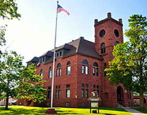
Gogebic County is the westernmost county in the Upper peninsula in the state of Michigan. Based on the 2010 census, the population was
16,427. The county seat is Bessemer. Gogebic County name probably comes from the Ojibwe language word bic, meaning rock.
The county was set off and organized in 1887. It had been part of Ontonagon County.
Etymology - Origin of Gogebic County Name
The name is said to be derived from the Ojibwe word "bic" which most references interpret as "rock." Alternatively, it is claimed to be derived from Lake Agogebic, later changed to Lake Gogebic
Demographics:
County QuickFacts: CensusBureau Quick Facts
Gogebic County History
Gogebic County probably comes from the Ojibwe language word bic, meaning rock.
Set Off: 1887
Organized: 1887
Geography: Land and Water
As reported by the Census Bureau, the county has a total area of 1,476 square miles (3,820 km2), of which 1,102 square miles (2,850 km2) is land and 374 square miles (970 km2) (25%) is water.
Lake Gogebic, the largest lake of the Upper Peninsula of Michigan, lies partially in Gogebic County.
Neighboring Counties
Bordering counties are as follows:
- Ontonagon County (north)
- Iron County (east)
- Vilas County, Wisconsin (south)
- Iron County, Wisconsin (southwest)
Education


Click Image to Enlarge
