


Michigan Counties

Click Image to Enlarge
Michigan Counties
The boundaries of the eighty-three counties in Michigan have not changed substantially since 1897. Wayne County was the sixth county in the Northwest Territory, formed 15 August 1796 and organized in 1815. Wayne County was created 21 November 1815 as an original county of Michigan.Iron County, Michigan
Iron County Education, Geography, and History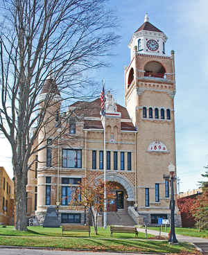
Iron County is a county located in the Upper Peninsula of the state of Michigan. Based on the 2010 census, the population was 11,817. The county seat is Crystal Falls.
Etymology - Origin of Iron County Name
Iron County is named for the iron resources found widely in the county.
Demographics:
County QuickFacts: CensusBureau Quick Facts
Iron County History
Iron County is named for the iron resources found widely in the county.
Set Off: 1885
Organized: 1885
Geography: Land and Water
As reported by the Census Bureau, the county has a total area of 1,211 square miles (3,140 km2), of which 1,166 square miles (3,020 km2) is land and 45 square miles (120 km2) (3.7%) is water
Neighboring Counties
Bordering counties are as follows:
- Houghton County (north)
- Baraga County (north)
- Marquette County (northeast)
- Ontonagon County (northwest)
- Dickinson County (east)
- Gogebic County (west)
- Florence County, Wisconsin (southeast)
- Forest County, Wisconsin (south)
- Vilas County, Wisconsin (southwest)
Education
West Iron County Schools
Forest Park School District
Compare More Colleges and Universities

County Resources

Click Image to Enlarge

Search
© Copyright 2004-2024, eRD (eReferenceDesk.com) owned and operated by Joseph L Ferguson. All rights reserved.