


Click Image to Enlarge
Michigan Counties
The boundaries of the eighty-three counties in Michigan have not changed substantially since 1897. Wayne County was the sixth county in the Northwest Territory, formed 15 August 1796 and organized in 1815. Wayne County was created 21 November 1815 as an original county of Michigan.Tuscola County, Michigan
Tuscola County Education, Geography, and History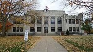
Tuscola County is a county located in the Thumb region of the state of Michigan. Based on the 2010 census, the population was 55,729. The county seat is Caro. The county was created by Michigan Law on April 1, 1840, from land in Sanilac County and attached to Saginaw County for administrative purposes. The Michigan Legislature passed an act on March 2, 1850, that empowered the county residents to organize governmental functions
Etymology - Origin of Tuscola County Name
Tuscola County was a name created by Henry Schoolcraft. Once called 'Tusci' by Native People, "Les Pays Plat' by the French, and Flat Country by the English, the name seems to mean plateau. Chief Otusson's reservation was partly in Tuscola County. His name meant bench. Caro, the county seat, was called by Native People "High Banks".
Demographics:
County QuickFacts: CensusBureau Quick Facts
Tuscola County History
The name Tuscola was a Neologism created by Henry Schoolcraft. One scholar believes it to be a combination of "dusinagon" (level) and "cola" (lands). "Dusinagon", actually, means plate. The Thumb of Michigan was once called by the French "Les Pays Plat", which was continued by the English in the name Flat Country. Native People called Tuscola, and perhaps the Thumb of Michigan, "Tusci", which likely comes from "Tes-aki", which likely means "bench-land" or a plateau. Tes-aki, then, has the same meaning as Les Pays Plat. Interestingly, during the Saginaw Treaty of 1819, the major chief of Tuscola was Chief Otusson, whose name was said to mean "bench in a lodge" or platform. Caro, Michigan, the county seat was called by Native People "High Banks"
Set Off: 1840
Organized: 1850
Geography: Land and Water
As reported by the Census Bureau, the county has a total area of 914 square miles (2,370 km2), of which 803 square miles (2,080 km2) is land and 111 square miles (290 km2) (12%) is water.
Neighboring Counties
Bordering counties are as follows:
- Huron County (north)
- Sanilac County (east)
- Saginaw County (west)
- Lapeer County (southeast)
- Genesee County (southwest)
- Bay County (northwest)
Education


Click Image to Enlarge
