


Click Image to Enlarge
Minnesota Counties
There are eighty-seven Counties in Minnesota. On October 27, 1849 nine large Minnesota Counties were created. Among them were Benton, Dahkotah, Itasca, Ramsey, Mahkahta, Pembina, Wabashaw, Washington, and Wahnata. Of those Benton, Dakota, Itasca, Ramsey, Wabasha, and Washington still exist as their original name. With the creation of Kittson County on March 9, 1878, Pembina County no longer existed. When Minnesota was organized as a state, 57 of the present 87 Counties were established. The last county to be created was Lake of the Woods County in 1923Becker County, Minnesota
Becker County Education, Geography, and History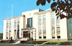
Becker County is a county located in the state of Minnesota. Based on the 2010 census, the population was 32,504. Its county seat is Detroit Lakes. A portion of the White Earth Indian Reservation extends into the county. The county was created in 1858 and organized in 1871.
Etymology - Origin of Becker County Name
Named for George Loomis Becker, mayor of St. Paul, 1856; state senator, 1868-71.
Demographics:
County QuickFacts: CensusBureau Quick Facts
Becker County History
Becker County became a county on March 18, 1858. It was named after Brigadier General George Loomis Becker
(1829-1904). Becker was one of three men elected to congress when Minnesota became a state, but since Minnesota could only send two, Becker
elected to stay behind, and he was promised to have a county named after him.
The city of Detroit Lakes was founded by Colonel George Johnston in 1871, the city grew quickly with the construction of the Northern Pacific
Railroad. Colonel Johnston had led settlers entirely hailing from the New England states to settled in this region. In 1877, an election
finally decided that Detroit Lakes, then known as Detroit, was to become the county seat. Detroit won the election by a ninety percent
majority. Frazee, Lake Park, and Audubon were also in the running for the county seat.
Geography: Land and Water
As reported by the Census Bureau, the county has a total area of 1,445 square miles (3,740 km2), of which 1,315 square miles (3,410 km2)
is land and 130 square miles (340 km2) (9.0%) is water.
Becker County has much diversity in its topographical features. Becker County is home to several hundred lakes, many acres of fertile farm
land, and forested areas. Much of the land consists of hills and deciduous trees.
Neighboring Counties
Bordering counties are as follows:
- Mahnomen County (north)
- Clearwater County (northeast)
- Hubbard County (northeast)
- Wadena County (southeast)
- Otter Tail County (south)
- Clay County (west)
- Norman County (northwest)
Education


Click Image to Enlarge
