


Click Image to Enlarge
Minnesota Counties
There are eighty-seven Counties in Minnesota. On October 27, 1849 nine large Minnesota Counties were created. Among them were Benton, Dahkotah, Itasca, Ramsey, Mahkahta, Pembina, Wabashaw, Washington, and Wahnata. Of those Benton, Dakota, Itasca, Ramsey, Wabasha, and Washington still exist as their original name. With the creation of Kittson County on March 9, 1878, Pembina County no longer existed. When Minnesota was organized as a state, 57 of the present 87 Counties were established. The last county to be created was Lake of the Woods County in 1923Big Stone County, Minnesota
Big Stone County Education, Geography, and History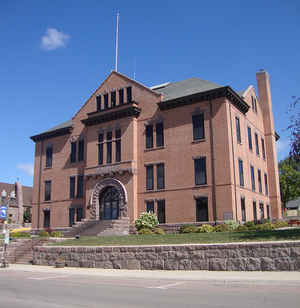
Big Stone County is a county located in the state of Minnesota. Based on the 2010 census, the population was 5,269. Its county seat is Ortonville. The county was formed in 1862 and organized in 1874.
Etymology - Origin of Big Stone County Name
Named for Big Stone Lake. Big Stone is the translation of the Dakota name for the lake, which alludes to large outcropping of granite near the foot of the lake.
Demographics:
County QuickFacts: CensusBureau Quick Facts
Big Stone County History
Following the Indian outbreak, western Minnesota was practically deserted, except for soldiers, stationed at
various points, who patrolled the frontier to protect the settlements farther east. Sioux bands of Sisseton and Wahpeton continued for some
years to wander over the nearby Dakota prairies to which they had fled. Fear of all Indians was intense. Even had the settlers been
sufficiently courageous to homes in the deserted area, they could not have obtained land titles because no surveys had been made.
Settlement of the Big Stone area was accordingly delayed. There were but six houses in the county on August 13, 1870. The population consisted
of two families with young children, two young couples, a bachelor living alone, and a widow whose children varied in age from a baby to two
sons approaching their majority. The last-named family had a young woman helper. Of the adults, two were born in Massachusetts, two in
Wisconsin, one in Kentucky, one in Tennessee, and five in Norway. Eight of the minors were born in Minnesota, five in Tennessee. Government
surveys were made in 1871 and 1872. People then came in gradually, but even as late as the spring of 1875 there were only 85 families in the
county. The influx of settlement that followed that date increased the population to 8731 at the close of the next quarter century.
Big Stone was established as a county by an act of the Legislature in 1862. No attempt to organize a county government was made until 1873,
when Gov. Horace Austin appointed three commissioners for that purpose. These appointed commissioners did nothing, and in March 1874, Gov. C.
K. Davis appointed three others who met and named a chairman and an auditor. At their second meeting on July 20, 1874, other county officers
were appointed, the boundaries of three commissioner districts were laid out, and the county seat was located at Ortonville. Soon afterward
four election precincts were established. A full set of county officers, with the exception of a clerk of the district court, was elected in
the fall of 1874. The county continued to function until the men elected in the fall of 1876 took office at the beginning of 1877. As a test
of the validity of the county organization, suits were brought to oust these officers. The Supreme Court held that the power or "organizing" a
county rested solely with the Legislature and that Big Stone County was merely "established" by that body. The county therefore had not been
organized and no offices existed. The county remained unorganized until 1881, when an act of the Legislature declared it organized. The county
was divided into five commissioner districts in February 1881.
Big Stone County received its name from Big Stone Lake. The name was a translation of a Sioux name for the outcrops of granite and gneiss
found in the Minnesota Valley not far away.
Geography: Land and Water
As reported by the Census Bureau, the county has a total area of 528 square miles (1,370 km2), of which 499 square miles (1,290 km2) is land and 29 square miles (75 km2) (5.5%) is water.
Big Stone Lake on the western edge of the county, and Lake Traverse, just north of it, lie in the valley channeled by the River Warren
which, toward the close of the last glacial epoch, flowed from glacial Lake Agassiz. The part of the ancient watercourse between these two
lakes, a distance of five miles, is called Brown' Valley. (This valley forms the lowest point of a continental divide.) The waters of Lake
Traverse reach Hudson Bay through the Bois de Sioux River, the Red River of the North, Lake Winnipeg, and the Nelson River. The drainage from
Lake Traverse reaches the Gulf of Mexico through the Minnesota and Mississippi Rivers.
The greater part of Big Stone County is a rolling prairie of till plain with a clay loam soil dotted with several small lakes. A morainic belt
in the northwestern part of the county leads southward near Beardsley to Big Stone Village, where it continues on the South Dakota side of the
lake re-entering Minnesota in the southern part of Big Stone County is mainly to the Minnesota River except in the northeast corner of the
county where it tends toward the Mustinka River and through the stream to the Red River of the North.
The natural drainage lines are imperfect and are supplemented by large ditches that have been dug along highways. Part of the Minnesota Valley
in the county is too wet for cultivation. Ledges of granite are found in the valley not far from Big Stone Lake. There are also many boulders.
Big Stone Lake is 26 miles long and from one to one and a half miles wide. Although called a lake, it is really a widened part of the
Minnesota River. There were more than 50 lakes in the county in the early eighties but many have dried up, and recent maps show only a few.
The largest are Artichoke and Toqua. The Minnesota River, rising in the coteau of western South Dakota, enters the State of Minnesota near
Browns Valley village, flows into Big Stone Lake at its northern end and out of the lake at the southern extremity.
Neighboring Counties
Bordering counties are as follows:
- Traverse County, Minnesota (north)
- Stevens County, Minnesota (northeast)
- Swift County, Minnesota (southeast)
- Lac qui Parle County, Minnesota (south)
- Grant County, South Dakota (southwest)
- Roberts County, South Dakota (northwest)
Education


Click Image to Enlarge
