


Click Image to Enlarge
Minnesota Counties
There are eighty-seven Counties in Minnesota. On October 27, 1849 nine large Minnesota Counties were created. Among them were Benton, Dahkotah, Itasca, Ramsey, Mahkahta, Pembina, Wabashaw, Washington, and Wahnata. Of those Benton, Dakota, Itasca, Ramsey, Wabasha, and Washington still exist as their original name. With the creation of Kittson County on March 9, 1878, Pembina County no longer existed. When Minnesota was organized as a state, 57 of the present 87 Counties were established. The last county to be created was Lake of the Woods County in 1923Chisago County, Minnesota
Chisago County Education, Geography, and History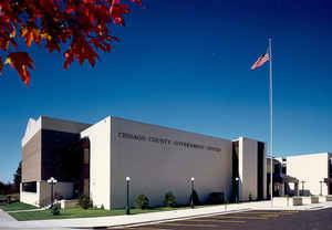
Chisago County is a county located in the state of Minnesota. Based on the 2010 census, the population was 53,887. Its county seat is
Center City. The county's name comes from Chisago Lake.
Chisago County is included in the Minneapolis-St. Paul-Bloomington, MN-WI Metropolitan Statistical Area.
Etymology - Origin of Chisago County Name
Named for Chisago Lake. Chisago is an anglicized version of the Ojibway words kichi and saga which mean "large" and "lovely", respectively.
Demographics:
County QuickFacts: CensusBureau Quick Facts
Chisago County History
Chisago County was organized in 1851. It took its name from Chisago Lake
Chisago County and Saint Croix River Valley history:
Chisago County was established in the fall of 1851 by an act of the territorial legislature of Minnesota. The name is derived from the
Native American phrase for the "large and lovely" lakes in the area. It would be almost seven years before Minnesota itself gained statehood,
on May 11th, 1858.
Chisago County is located about 20 miles north of the Twin Cities metropolitan area and extends another 30 miles north, along the wild and
scenic St. Croix River, which forms its eastern border. Within the 450 square miles (1,170 hectares), recreational opportunities abound!
The St. Croix River Valley was first inhabited by nomadic people some 6,000 years ago. For thousands of years the valley was home to both
Dakota [Sioux] and Ojibwa [Chippewa] Indians. These tribes were largely gone by the time steamboats from the south began to arrive in 1838.
Soldiers, yankee businessmen, and land speculators came and established their places. The white pine logging industry and sawmills flourished
along the river while many crops were grown on the freshly cleared farmland.
Construction of the first Government Road from Fort Snelling to Lake Superior began in 1852. The road (shown in pink on the map to the right)
passed through the county, following the bluff line of the St. Croix River. It carried new settlers into the territory and later saw scheduled
stagecoach and mail service. Portions of the route, also known as the Point Douglas Superior Military Road, are now designated as a Minnesota
Scenic Byway.
Tracks for the Lake Superior and Mississippi Railroad soon swept along the west side of the county. A network of roadways began to develop,
criss-crossing the area, bringing both people and goods to the new depots.
Swedish immigrants were the predominant group who established the churches and communities of the mid to late 1800's. Their hardships and joys
are captured in a series of epic novels written by Vilhelm Moberg, a Swedish author who spent the summer of 1948 in the Chisago Lakes area.
Minnesota Highway 8, which connects Forest Lake to Taylors Falls, is today known as the Moberg Commemorative Trail (shown in yellow on the
map). Towns along the route have Swedish sister cities that can be visited by following the links in the listing to the right.
Early settlement in the area was slow but steady for the first 40 years, followed by 60 years of minimal change. The table below is from US
Federal Census Data and shows Chisago County population had grown to 10,000 people by 1890. There has been rapid growth during the past 50
years. Click on the table to see the graph view.
During the past two decades Chisago County has been one of the faster growing counties in Minnesota. Easy access from Minneapolis and St.
Paul, the natural scenic beauty of the St. Croix river and its local lakes make the county a great place to visit and live.
Chisago County Historical Society
P.O. Box 146
Lindstrom, MN 55045
Geography: Land and Water
As reported by the Census Bureau, the county has a total area of 442 square miles (1,140 km2), of which 415 square miles (1,070 km2) is land and 28 square miles (73 km2) (6.2%) is water.
Neighboring Counties
Bordering counties are as follows:
- Pine County, Minnesota (north)
- Burnett County, Wisconsin (northeast)
- Polk County, Wisconsin (east)
- Washington County, Minnesota (south)
- Anoka County, Minnesota (southwest)
- Isanti County, Minnesota (west)
- Kanabec County, Minnesota (northwest)
Education


Click Image to Enlarge
