


Click Image to Enlarge
Minnesota Counties
There are eighty-seven Counties in Minnesota. On October 27, 1849 nine large Minnesota Counties were created. Among them were Benton, Dahkotah, Itasca, Ramsey, Mahkahta, Pembina, Wabashaw, Washington, and Wahnata. Of those Benton, Dakota, Itasca, Ramsey, Wabasha, and Washington still exist as their original name. With the creation of Kittson County on March 9, 1878, Pembina County no longer existed. When Minnesota was organized as a state, 57 of the present 87 Counties were established. The last county to be created was Lake of the Woods County in 1923Clay County, Minnesota
Clay County Education, Geography, and History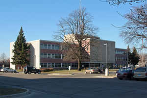
Clay County is a county located in the state of Minnesota. Based on the 2010 census, the population was 58,999. Its county seat is
Moorhead. The county's name is in honor of American statesman Henry Clay, member of the United States Senate from Kentucky and United States
Secretary of State in the 19th century. The county was formed in 1862 and organized in 1872. It was originally called Breckenridge County, but
changed to its current name in 1862.
Clay County is part of the Fargo, ND-MN Metropolitan Statistical Area.
Etymology - Origin of Clay County Name
Named for Henry Clay, American statesman. US Senator and Congressman from Kentucky variously during the period 1806-52; US Secretary of State, 1825-29; three times Speaker of the House, and three times a candidate for president.
Demographics:
County QuickFacts: CensusBureau Quick Facts
Clay County History
Clay County, located along the west border of Minnesota, was established in 1858 as Breckenridge County, named for John
C. Breckenridge, Vice President of the United States from 1857-1861.
Minnesota Governor Ramsey appointed the 1st county commissioners in 1861: R. M. Probstfield, Richard Manning and George Northrup. Today, the
county is represented by 5 commissioners.
After the Civil War started, Breckenridge joined the army of the South. Pressure by Minnesota residents resulted in the State Legislature of
Minnesota passing a bill on March 6, 1862, rescinding the name of Breckenridge. The county was then renamed for Henry Clay (1777-1852). Clay
was known as a statesman and orator, and called "The Great Pacificator".
In 1871, a decision was made to have the Northern Pacific Railroad cross the Red River at the present site of Moorhead. The railroad bought
Job Smith's land, platted a townsite, offered lots for sale, and named the town Moorhead.
Moorhead was designated the county seat on June 1, 1872, and a county building was built at 5th Street and 1st Avenue North. Today, the
fountain in the Moorhead Center Mall is located in about the same spot where the 1st Clay County Courthouse once stood. The first courthouse
was sold in 1878.
In 1878 a 2nd courthouse was built at 8th Street and 1st Avenue North at a cost of $2,136. Plans for this courthouse set off the fight for the
county seat in 1879. Works Progress Administration (WPA) workers tore down the 2nd courthouse in the mid 1930s. A 3rd courthouse was built in
1882 on the eastern half of the present site at 11th Street and 8th Avenue North. The cost of that building was $50,000. The building cost of
the present courthouse, which was built in 1954, was $704,000.
Geography: Land and Water
As reported by the Census Bureau, the county has a total area of 1,053 square miles (2,730 km2), of which 1,045 square miles (2,710 km2) are land and 7.3 square miles (19 km2) (0.7%) are covered by water
Neighboring Counties
Bordering counties are as follows:
- Norman County (north)
- Becker County (east)
- Otter Tail County (southeast)
- Wilkin County (south)
- Richland County, North Dakota (southwest)
- Cass County, North Dakota (west)
Education


Click Image to Enlarge
