


Click Image to Enlarge
Minnesota Counties
There are eighty-seven Counties in Minnesota. On October 27, 1849 nine large Minnesota Counties were created. Among them were Benton, Dahkotah, Itasca, Ramsey, Mahkahta, Pembina, Wabashaw, Washington, and Wahnata. Of those Benton, Dakota, Itasca, Ramsey, Wabasha, and Washington still exist as their original name. With the creation of Kittson County on March 9, 1878, Pembina County no longer existed. When Minnesota was organized as a state, 57 of the present 87 Counties were established. The last county to be created was Lake of the Woods County in 1923Freeborn County, Minnesota
Freeborn County Education, Geography, and History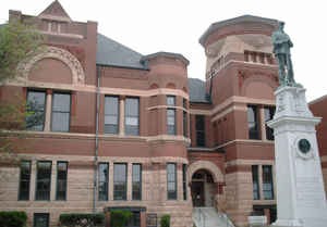
Freeborn County is a county located in the State of Minnesota. Based on the 2010 census, the population was 31,255. Its county seat is Albert
Lea.
Freeborn County comprises the Albert Lea, MN Micropolitan Statistical Area.
Etymology - Origin of Freeborn County Name
Named for William Freeborn, member of the council in the territorial legislature, 1854-57; second mayor of Red Wing, 1858
Demographics:
County QuickFacts: CensusBureau Quick Facts
Freeborn County History
Freeborn County was established in 1855. It is named for William Freeborn, an early Minnesota politician.
An Ohio man who never actually settled in the Albert Lea area but who was one of Minnesota's earliest pioneers now is remembered in the
name of Freeborn County.
The county was named after William Freeborn who was born in Ohio and moved to St. Paul in 1848.
While in St. Paul he was a member of the Council-or the Upper House-in the first Minnesota territorial legislature. With a small band of
hearty pioneers, Freeborn first settled and developed the town of Red Wing on the Mississippi River in 1853.
Historians tell that Freeborn was an energetic man with progressively bold ideas and the ability to interest other persons in his many
enterprises.
A short time after he and his party settled Red Wing, the outpost became an important outlet for this section of the new country being carved
out of prairie and wilderness. A stage line soon was started between Red Wing and Albert Lea, which had been settled at about the same time by
George Ruble, a close friend of Freeborn'.
Not only did Ruble play an instrumental role in naming the city of Albert Lea after the colonel by that name, he also took it upon himself to
see that the county surrounding "his town?#8364;? took on the name of his friend Freeborn.
Historian' record that Ruble used his friendship with Freeborn in the early territorial legislature to get Freeborn County created by
legislative act. At the time Freeborn served as district 3 representative for Goodhue, Dodge, and Freeborn Counties.
The man from Ohio was one of the founders of Hamline University in St. Paul.
There is no record of William Freeborn ever having been a resident of Albert Lea, thought be is recorded to have owned property in the area.
His name appeared on the first tax roll in District 3 as published in the Southern Minnesota Star on Sept. 12, 1857, a few months after the
new Freeborn County was organized officially at a meeting at the home of George Ruble.
At the 7th Territorial Legislature in 1856, William Sherwood Freeborn represented the 4th District, as he did in 1857 when the Territorial
Legislature passed an act authorizing the organization of Freeborn County. The first meeting of the Board of County Commissioners, appointed
by Governor Gorman, was held at the home of George S. Ruble in the village of Albert Lea, 3 March 1857. It was at this meeting that the county
was given the name of Freeborn in honor of William S. Freeborn. (It is interesting to note that he never lived in the county! He came to St.
Paul in 1848, moved to Goodhue County in 1852, and then moved out West in 1864. He died in California in 1900.
Though Freeborn County is recorded by historians as having been "created" Feb. 20, 1855 no actual governmental recognition of such a creation
occurred until the spring of 1857. At that time the territorial legislature passed an act authorizing the organization of Freeborn County.
Accompanying the legislative act was a list of appointments from the governor for the filling of the various county government positions.
Appointed, as commissioners were William Andrews, E.C. Stacy, and S. N. Frisbie, Samuel M. Thompson, register of deeds; and Thomas C. Thorne,
treasurer.
The commissioners were directed by Governor Gorman to meet, appoint officers, name a temporary county seat, and transact other government
business.
Seven-hour meetings by the present Freeborn County Board of Commissioners may seem long and drawn out to today's spectator. However, such a
meeting schedule appears slight when compared to the sessions conducted by the first board, which have been recorded to have lasted in some
instances, for three days or more.
In October 1857, the first general election in the county was held and 642 votes were cast. Elected were commissioners S. N. Frisbie, Joseph
Rickard, and Peter Clausen; register of deeds William Morin; treasurer Henry King; sheriff J. W. Heath; probate judge A. W. White; clerk of
court E. P. Skinner; surveyor H. D. Brown; and coroner A. M. Burnham.
Albert Lea was selected as county seat.
Geography: Land and Water
As reported by the Census Bureau, the county has a total area of 722 square miles (1,870 km2), of which 707 square miles (1,830 km2) is land and 15 square miles (39 km2) (2.1%) is water. The Le Sueur River, a tributary of the Minnesota River, begins in the northern part of the county.
Neighboring Counties
Bordering counties are as follows:
- Steele County (northeast)
- Mower County (east)
- Worth County, Iowa (south)
- Winnebago County, Iowa (southwest)
- Faribault County (west)
- Waseca County (northwest)
Education


Click Image to Enlarge
