


Click Image to Enlarge
Minnesota Counties
There are eighty-seven Counties in Minnesota. On October 27, 1849 nine large Minnesota Counties were created. Among them were Benton, Dahkotah, Itasca, Ramsey, Mahkahta, Pembina, Wabashaw, Washington, and Wahnata. Of those Benton, Dakota, Itasca, Ramsey, Wabasha, and Washington still exist as their original name. With the creation of Kittson County on March 9, 1878, Pembina County no longer existed. When Minnesota was organized as a state, 57 of the present 87 Counties were established. The last county to be created was Lake of the Woods County in 1923Polk County, Minnesota
Polk County Education, Geography, and History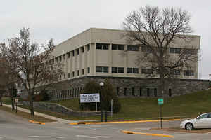
Polk County is a county located in the state of Minnesota. The population was at 31,600 at the 2010 census. Its county seat is
Crookston, and the largest community is East Grand Forks. The county was formed in 1858 and organized in 1872.
Polk County is included in the Grand Forks, ND-MN Metropolitan Statistical Area.
Etymology - Origin of Polk County Name
Named for James K. Polk, member of Congress from Tennessee, 1825-39; governor of Tennessee, 1839-41; president of the United States, 1845-49. On his last day in office, Polk approved the act of Congress which organized the Minnesota Territory.
Demographics:
County QuickFacts: CensusBureau Quick Facts
Polk County History
A Brief History of Polk County
Polk County in 1858 had the unique distinction of having two watersheds draining in
opposite directions. The Mississippi River, which formed the southeast boundary of the county from Lake Itasca to Cass Lake, emptied its water
ultimately in the Gulf of Mexico, while the Red River of the North, which formed the western boundary of the county, emptied its water into
Hudson Bay. After all of the changes in land area of the county had been made, the county today lies wholly in the Red River Valley.
In 1958, the land area of the county was less than one-half its original area. The land area of Polk County was established when Governor H.
H. Sibley signed the bill creating the county on July 27, 1858. The land area for the county was set off from the territorial county of
Pembina, which included parts of northwestern Minnesota and northeastern North Dakota. The law set up the southern boundary of Pembina as the
northern boundary of Polk County. When the present counties north of Polk were established, the name Pembina was erased from the county map of
Minnesota.
The boundaries of the county, as originally established, commenced at the southwest corner of Pembina county, opposite the mouth of the Turtle
River and running up the Red River to the mouth of the Buffalo River at Georgetown; thence, easterly up the Buffalo River along the northern
boundary of the then named Breckenridge County and then along the northern boundary of Becker County to the southeastern extremity of Lake
Itasca; then, north and east up the Mississippi to its intersection of the county's eastern boundary line at the northeast extremity of Cass
Lake; then, due north to the southern boundary of Pembina County, then, due west to the point opposite the mouth of the Turtle River, the
place of its beginning.
The first division of the county occurred in 1862, when a sizable strip of land across the southern boundary was allotted to Clay County. The
southern boundary of Polk and the northern boundary of Clay counties were established on a line between Townships 142 and 143.
The second division of Polk County occurred in 1866 when all of the land east, between the ranges 38 and 39, was set off to form a part of
Beltrami County. (The land adjacent to the eastern boundary of the county was later separated from Beltrami County to form the present
Clearwater County).
Some confusion occurred, regarding the northern boundary of Polk County, when Marshall County was established in 1879. The act establishing
Marshall County had the dividing line between the two counties, between Townships 154 and 155N, while the original boundary, when Polk was set
off from Pembina, was fixed between Sections 6 and 7, Township 154N. This boundary was reaffirmed by the following legislature, and remains at
the present northern county boundary. With the squaring up of the south and east boundaries, the land area of the county was reduced to 4,450
square miles.
At the 1880-81 session of the Minnesota Legislature, an act was passed creating the new county of Norman from the southern third of Polk
County. The new southern boundary of Polk County and the northern boundary of Norman County were fixed on an east and west line between
Townships 146 and 147. Norman County was allotted 1,432 square miles of land area and it in turn was later reduced when 572 square miles of
the eastern part was set off to form Mahnomen County.
The last division of Polk County took place following the general election 1896, when an irregular portion of the north central and northeast
townships, totaling 1,039 square miles, was set off to form Red Lake County. The eastern boundary of the central section of Polk and the
western boundary of Red Lake was established between Ranges 46W and 45W, beginning at the north boundary of the county and extending south to
the northern boundary of Township 150, Range 45W (Gentilly Township); thence south along the eastern boundary of that township to an east and
west line between Townships 149 and 150 to form the south boundary of Red Lake County. The southern boundary of Red Lake extends east to Range
41W, thence, north and east bordering on Township 150, Range 40W (Chester Township); thence, north and east following the west and northern
boundaries of Township 152, Range 39W (Johnson Township); thence, north along the eastern boundary of Polk County to the Marshall County line.
(Red Lake County, too, suffered dismemberment when in 1920 its north half [approximate] was set off to form Pennington County).
While the successful attempts to divide the land area have been duly documented, yet the history of Polk County would be incomplete unless a
brief account of the unsuccessful attempts to divide the county were made in this report. The writer, upon his arrival in Polk County, was
intrigued by the reports, many of them first hand from participants, of the unsuccessful attempts to divide the county. Argument for county
division was not without justification. Before the general use of the automobile in the early twenties, a relay journey by team and railroad
meant about a two-day trip to the county seat for residents in the northwestern and northeastern part of the county.
The ambitious and aspirations of the citizens of the towns and villages to become county seats were the other driving forces working for
county dismemberment. The law passed by the State Legislature in 1893, which permitted voters to decide at general elections on county
division, added fuel to the fire of enthusiasm of factional groups for county division. Four sectional groups filed petitions for county
divisions, which were voted on in the general election of 1894. The proposed divisions of the county with proposed county names and county
seats were: west, Nash with East Grand Forks as county seat; north central, Red Lake with Red Lake Falls as county seat; east, the group
favoring McIntosh as county seat submitted the name Columbia - those designating Fosston as the county seat submitted Nelson as the county
name. This first attempt to slice up the county into three parts failed.
The following session of the legislature amended the County Division Law to permit voters to vote on only one division proposal at any one
election. Similar petitions for county division were again placed before the voters in the general election of 1896. This election carried for
Red Lake County. The last important county division election occurred in 1902 when petitioners sought to separate the eastern part from the
parent county.
The late Charles Conger, a friend who then resided in McIntosh, gave an excellent report of the county division fight in the 1916 HISTORY AND
BIOGRAPHY OF POLK COUNTY, entitled "The rise and Fall of Columbia County". The four petitions voted on in the 1902 election were in agreement
on land area, fixing the line of separation on the western boundaries of Garden, Woodside and Grove Park Townships. The groups were in
disagreement, however, on the county names and county seat towns. The proposed county names and county seats were: Nelson with Fosston,
Columbia with McIntosh, North Star with Erskine and Valley with Mentor. The petition for Columbia County carried the most yes votes and
Governor Van Sant issued his proclamation declaring the proposition for the creation and organization of the Columbia County carried.
The new Columbia County proceeded to organize the commissioners named in the petition as the organizing agency. The legality of the election
was questioned, inasmuch as all petitions included the same land area. Polk County contested the election before the State Supreme Court. The
Supreme Court handed down its decision on April 16, 1903, stating, "That the pretended organization of the new county was invalid and of no
effect and its pretended officials were ousted from the offices they claimed to hold". Considerable business had been transacted by the new
county officials before the Supreme Court decision was handed down. The 1907 legislature however legalized in part many of the acts of the
temporary organization pertaining primarily to estates, tax payments, marriage licenses and other minor matters. The final attempt to divide
the county by the Nelson County advocates was decisively defeated in the 1908 election.
One interesting sidelight of legal significance was brought out in the final division of the county. The issue in controversy, between Polk
and Red Lake counties, was whether or not Red Lake County should bear its share of the bonded indebtedness incurred while it was still a part
of Polk County. The State Supreme Court reversed the decision of District Judge William Watts and ruled that Red Lake County should pay its
share.
By T. M. McCall, 1961
Geography: Land and Water
As reported by the Census Bureau, the county has a total area of 1,998 square miles (5,170 km2), of which 1,971 square miles (5,100 km2) is land and 27 square miles (70 km2) (1.3%) is water.
Neighboring Counties
Bordering counties are as follows:
- Marshall County (north)
- Pennington County (northeast)
- Red Lake County (northeast)
- Clearwater County (east)
- Mahnomen County (southeast)
- Norman County (south)
- Traill County, North Dakota (southwest)
- Grand Forks County, North Dakota (west)
Education


Click Image to Enlarge
