


Click Image to Enlarge
Minnesota Counties
There are eighty-seven Counties in Minnesota. On October 27, 1849 nine large Minnesota Counties were created. Among them were Benton, Dahkotah, Itasca, Ramsey, Mahkahta, Pembina, Wabashaw, Washington, and Wahnata. Of those Benton, Dakota, Itasca, Ramsey, Wabasha, and Washington still exist as their original name. With the creation of Kittson County on March 9, 1878, Pembina County no longer existed. When Minnesota was organized as a state, 57 of the present 87 Counties were established. The last county to be created was Lake of the Woods County in 1923St. Louis County, Minnesota
St. Louis County Education, Geography, and History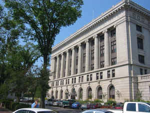
Saint Louis County (abbreviated St. Louis County) is a county located in the state of Minnesota. Based on the 2010 census, the population
was 200,226. Its county seat is Duluth. It is the largest county by total area in Minnesota, and the second largest in the United States east
of the Mississippi River by land area, after Aroostook County, Maine.
Saint Louis County is included in the Duluth, MN-WI Metropolitan Statistical Area.
Etymology - Origin of St. Louis County Name
Named for the St. Louis River. The St. Louis River was named by the French explorer Verendrye in honor of being awarded the order of St. Louis by the King of France in 1749.
Demographics:
County QuickFacts: CensusBureau Quick Facts
St. Louis County History
Saint Louis County was founded on February 20, 1855, as Doty County, and had its name changed to Newton County on March 3, 1855. It originally consisted of the area east and south of the Saint Louis River, while the area east of the Vermilion River and north of the Saint Louis River was part of Superior County. Superior County was renamed Saint Louis County. Then on March 1, 1856, that Saint Louis County became Lake County, and Newton County was renamed Saint Louis County and had that eastern area added to it; it was also expanded westward by incorporating parts of Itasca County, which then also included most of Carlton County. On May 23, 1857, Saint Louis County took its current shape when Carlton County was formed from parts of Saint Louis and Pine counties.
Geography: Land and Water
As reported by the Census Bureau, the county has a total area of 6,860 square miles (17,800 km2), of which 6,247 square miles (16,180
km2) is land and 612 square miles (1,590 km2) (8.9%) is water. By area, it is the largest county in Minnesota and the second largest in the
US east of the Mississippi River.
Saint Louis County is known for its spectacular natural beauty. Voyageurs National Park, established in 1975, is located in its northwestern
corner, on the south shore of Rainy Lake, on the Ontario, Canada border, and is popular with canoeists, kayakers, other boaters and fishermen.
The county also includes parts of Superior National Forest, established in 1909, and the Boundary Waters Canoe Area Wilderness within it on
the US-Canadian border, established in 1978. The BWCAW is a 1,090,000-acre (4,400 km2) wilderness area designated for fishing, camping,
hiking, and canoeing and is one of the most visited wilderness areas in the United States. Saint Louis County has over 500 lakes, including
Rainy Lake, Kabetogama Lake, Namakan Lake, Sand Point Lake, and Crane Lake. The largest lakes are Pelican and Vermilion.
The "Hill of Three Waters" on the Laurentian Divide lies just north of Virginia. Rain falling on this hill runs to three watersheds: Hudson
Bay to the north, the Gulf of Saint Lawrence to the east (via Lake Superior), or the Gulf of Mexico to the south and west (via the Mississippi
River). The county is drained by the Saint Louis, Vermilion, and other rivers.
Saint Louis County has one of the most important fresh-water ports in the United States, located in Duluth on Lake Superior.
The county encompasses part of the Iron Range, which has a significant taconite mining industry, particularly in the city of Virginia.
Neighboring Counties
Bordering counties are as follows:
- Rainy River District, Ontario, Canada (north)
- Lake County (east)
- Douglas County, Wisconsin (southeast)
- Carlton County (south)
- Aitkin County (southwest)
- Itasca County (west)
- Koochiching County (northwest)
Education


Click Image to Enlarge
