


Click Image to Enlarge
Mississippi Counties
There are eighty counties in Mississippi. Two original counties were Adams County and Jefferson County (formerly Pickering) established in 1799Hinds County, Mississippi
Hinds County Education, Geography, and History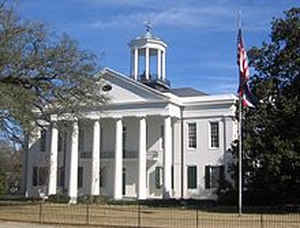
Hinds County is a county located in the State of Mississippi. Based on the 2010 census, the population was 245,285, making it the most
populous county in Mississippi. Its county seats are Raymond and Jackson, the state capital. The county is named for General Thomas Hinds, a
hero of the Battle of New Orleans during the War of 1812.
Hinds County is part of the Jackson, MS Metropolitan Statistical Area. It is a center of professional, educational, business and industrial
elites in the state. It is bordered on the northwest by the Big Black River and on the east by the Pearl River. It is one county width away
from the Yazoo River and the southern border of the Mississippi Delta.
Etymology - Origin of Hinds County Name
Hinds is named for US Congressman from Mississippi Thomas Hinds. Thomas Hinds (January 9, 1780 - August 23,
1840) was a politician from the state of Mississippi.
Born in Berkeley County, Virginia (now West Virginia), Hinds would later move to Greenville, Mississippi. He served
as major of cavalry in the War of 1812 and distinguished himself at the Battle of New Orleans, later being brevetted
brigadier general for gallantry.
Demographics:
County QuickFacts: CensusBureau Quick Facts
Hinds County History
Hinds County was created on February 12, 1821. It was named in honor of Gen. Thomas Hinds, who, with General Jackson, were the United States Commissioners appointed to treat with the Choctaws and obtain the cession noted. The Legislature of the State of Mississippi passed an act declaring that
"all that tract of land ceded to the United States by the Choctaw Nation of Indians on the 18th day of October, 1820, and bounded as follows, that is to say: Beginning on the Choctaw boundary, east of Pearl River, at a point due south of the White Oak Spring on the old Indian path; thence in a direct line to a black oak standing on the Natchez road, about forty poles eastward from Doak's Fence, marked A. J., and blazed with two large pines, and a black oak standing near thereto, and marked as pointers; thence a straight line to the head of Black Creek, or Bogue Loosa, to a small lake; thence a direct course so as to strike the Mississippi one mile below the Arkansas River; thence down the Mississippi to the mouth of the Yazoo River; thence along the line heretofore known by the name of the Indian Boundary line, to the beginning, shall be, and is hereby directed and established into a new county, which shall be called and known by the name of Hinds County."
Many Counties were formed from Hinds County. On January 21, 1823, the legislature created Yazoo County out of
Hinds, and by the same act the county of Copiah. A little later, February 4, 1828, from all that portion of Hinds
County lying east of the Pearl River, the county of Rankin was erected. And on February 5, 1829, Hinds County
surrendered "the fractional township seven, in ranges two and three- to be attached to Madison County."Out of these
several counties many other counties have been created, so that Hinds is indeed the "mother of counties."
The county seat was at Clinton for a short time, but on February 4, 1828, the Legislature ordered the election of
five commissioners to locate a site for a court house, and they were directed to put it in Clinton or within two
miles of the center of the county. This center was found within two miles of Raymond and was marked by a large
stone; next year, by act of the legislature, Raymond was made the county seat. Here the old records of the county
are kept, though courts are also held at the capital, Jackson, the county being divided into two court districts.
The capital of the State was located at Jackson within its borders, November 28, 1821,
Geography: Land and Water
As reported by the Census Bureau, the county has a total area of 877 square miles (2,272 km2), of which, 869
square miles (2,251 km2) of it is land and 8 square miles (21 km2) of it (0.93%) is water.
Neighboring Counties
Bordering counties are as follows:
- Madison County (northeast)
- Rankin County (east)
- Copiah County (south)
- Claiborne County (southwest)
- Warren County (west)
- Yazoo County (northwest)
Education
Public school districts
Clinton Public School District
Hinds County School District (Raymond)
Jackson Public School District
Private schools
Clinton Christian Academy (Clinton)
Hillcrest Christian School (Jackson)
Jackson Academy (Jackson)
Mt. Salus Christian School (Clinton)
Rebul Academy (Learned)
Colleges and universities
Belhaven University (Jackson)
Hinds Community College (Raymond)
Jackson State University (Jackson)
Millsaps College (Jackson)
Mississippi College (Clinton)
Mississippi College School of Law (Jackson)
Reformed Theological Seminary (Jackson)
Tougaloo College (Tougaloo)
University of Mississippi Medical Center (Jackson)
Wesley Biblical Seminary (Jackson)


Click Image to Enlarge
