


Click Image to Enlarge
Mississippi Counties
There are eighty counties in Mississippi. Two original counties were Adams County and Jefferson County (formerly Pickering) established in 1799Holmes County, Mississippi
Holmes County Education, Geography, and History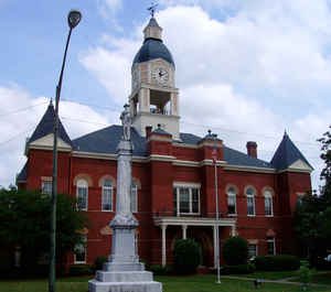
Holmes County is a county in the state of Mississippi; its western border is formed by the Yazoo River and the eastern border by the Big Black River. The western part of the county is within the Yazoo-Mississippi Delta. Based on the 2010 census, the population was 19,198. Its county seat is Lexington. The county is named in honor of David Holmes, territorial governor and the first governor of the state of Mississippi.
Etymology - Origin of Holmes County Name
Holmes is named for David Holmes, Governor of Mississippi Territory and later Governor of Mississippi. David
Holmes (March 10, 1769 - August 20, 1832) was the last governor of the Mississippi Territory and the first governor
of the State of Mississippi.
Born in York County, Pennsylvania, Holmes and his family moved to Virginia when he was a child. He served as US
Representative from Virginia from 1797 until 1808 when President Jefferson appointed him Mississippi's fourth
territorial governor. Holmes was very popular and his appointment marked the end of a long period of factionalism
within the territory.
Demographics:
County QuickFacts: CensusBureau Quick Facts
Holmes County History
Holmes County was created February 19, 1833. It was originally part of the territory forming the large county of Hinds, ceded to the United States by the Choctaw Indians in the Treaty of Doak's Stand, October 18, 1820, and long known as the "New Purchase." One of the counties created out of Hinds was Yazoo, and from Yazoo County was taken the region forming the present county of Holmes. It was named in honor of Gov. David Holmes, fourth Territorial governor, first State governor, and later United States Senator for Mississippi. The County seat is located at Lexington. The original act defines its limits as follows:
"Beginning at Bole's ferry, on Big Black, in the county of Yazoo, and in section 22, in township 12, and range 3 east; thence on a direct line to Yazoo River, at a point where the township line, between townships 13 and 14, strikes the same; thence up said river to a point on the same, 12 miles north of the township line, between townships 15 and 16; thence on a direct line, to the corner of the old Choctaw Boundary line on Black Creek, known by the name of Gum Corner; thence continuing the same course to Big Black; thence down the same, to the beginning."
In 1918, a portion of western Holmes County was contributed to the formation of Humphreys. Four of the oldest settlements in Holmes County were Rankin, Montgomery, Vernon and Georgevifle. All these old settlements are now extinct. Tradition recites that Etho Beau, a justice of the peace, held at Rankin, under the protection of a gun, the first county court. Rankin, was located about five miles from Tchula, and aspired at first to be the seat of justice of the new county. Captain Parrisot, father of Capt. S.H. Parrisot, and father-in-law of F. Barksdalle, of Yazoo City, settled near here in 1828, and kept a hotel in Rankin until 1834. Wm. MeLellan came from Biloxi in 1826 and settled on Little Black Creek on the east side. Montgomery (inc. 1836) was on the west bank of Big Black River at Pickens Ferry. Vernon was once a thriving town about 12 miles north of Lexington. Georgeville was situated in the northwest quarter of S. 35, T. 14, R. 3 east. In the early days of the county when it was sparsely settled many daring deeds, some of a romantic nature, others the outcome of outlawry were committed in the region, and several notorious robbers and counterfeiters, belonging to the much feared "Murrell clan", were captured at Tchula, severely punished and driven from the country.
Geography: Land and Water
As reported by the Census Bureau, the county has a total area of 764 square miles (1,979 km2), of which, 756
square miles (1,958 km2) of it is land and 8 square miles (21 km2) of it (1.07%) is water.
Neighboring Counties
Bordering counties are as follows:
- Carroll County (north)
- Attala County (east)
- Yazoo County (south)
- Humphreys County (west)
- Leflore County (northwest)
Education
Colleges
Holmes Community College (Goodman)
Public Schools
Durant Public School District
Durant Public School
Holmes County School District (Lexington)
Holmes County Central High School
S.V Marshall Middle School
Goodman-Pickens Elementary School
Lexington Elementary School
S.V. Marshall Elementary School
Williams-Sullivan Elementary School
The Learning Center
Vocational-Technical Center
Private Schools
Central Holmes Christian School (Lexington, formerly Central Holmes Academy), founded as a segregation academy
Old Dominion Christian School
Pillow Academy in unincorporated Leflore County, near Greenwood, enrolls some students from Holmes County. It originally was founded as a
segregation academy.


Click Image to Enlarge
