


Click Image to Enlarge
Mississippi Counties
There are eighty counties in Mississippi. Two original counties were Adams County and Jefferson County (formerly Pickering) established in 1799Leflore County, Mississippi
Leflore County Education, Geography, and History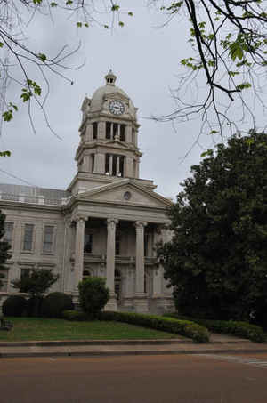
Leflore County is a county located in the state of Mississippi. Based on the 2010 census, the population was 32,317. The county seat is
Greenwood. The county is named for Choctaw leader Greenwood LeFlore, who signed a treaty to cede his people's land to the United States in
exchange for land in Indian Territory.
Leflore County is part of the Greenwood, MS Micropolitan Statistical Area. It is located in the Mississippi Delta region, with its southern
border formed by the Yazoo River. Its riverfront land were developed before the Civil War as cotton plantations. More inland areas were
developed in the later 19th century.
Etymology - Origin of Leflore County Name
Leflore is named for Choctaw leader Greenwood LeFlore. Greenwood LeFlore or Greenwood Le Fleur (June 3, 1800 - August 31, 1865) was an American Indian/European-American leader of the Choctaws and was a Mississippi senator. A wealthy and regionally influential trader with many connections in state and federal government, he was elected chief of the entire Choctaw tribe shortly before the Treaty of Dancing Rabbit Creek, becoming the first Principal Chief of a Choctaw Nation that had previously been governed by regional chiefs. During the American Civil War he sided with the Union and lost most of his valuables.
Demographics:
County QuickFacts: CensusBureau Quick Facts
Leflore County History
Leflore County was formerly a part of Sunflower, Carroll and Tallahatchie counties and was established March 15, 1871, during the administration of Governor Alcorn. It was directed, by the act creating the county, that the county records, together with the buildings and grounds at McNutt, now in Leflore County, should be retained by Leflore, and that the county seat should be located at Greenwood. Greenwood originally was known as Williams Landing but was re-named for Greenwood Leflore in 1844. Leflore shipped his cotton from Williams Landing, in what was then the extreme west of Carroll County, near the juncture of the Tallahatchie and Yalobusha Rivers.
Leflore County was named for Greenwood Leflore to complement the name of the town of Greenwood, which dates from
1844. LeFlore County, Oklahoma, also was named for him. Greenwood Leflore (1800-1865) was the principal chief of the
Choctaw at the time of removal and was one of the negotiators of the Treaty of Dancing Rabbit Creek.
Geography: Land and Water
As reported by the Census Bureau, the county has a total area of 606 square miles (1,570 km2), of which, 592
square miles (1,533 km2) of it is land and 14 square miles (37 km2) of it (2.38%) is water.
Neighboring Counties
Bordering counties are as follows:
- Tallahatchie County (north)
- Grenada County (northeast)
- Carroll County (east)
- Holmes County (southeast)
- Humphreys County (southwest)
- Sunflower County (west)
Education
Colleges and Universities
Mississippi Valley State University
It is located 1 mile (1.6 km) northwest of Itta Bena in an unincorporated area.
Public School Districts
Greenwood Public School District
Leflore County School District
Private Schools
Pillow Academy - formerly a segregation academy.


Click Image to Enlarge
