


Click Image to Enlarge
Mississippi Counties
There are eighty counties in Mississippi. Two original counties were Adams County and Jefferson County (formerly Pickering) established in 1799Oktibbeha County, Mississippi
Oktibbeha County Education, Geography, and History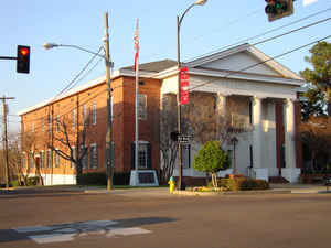
Oktibbeha County is a county located in the state of Mississippi. Based on the 2010 census, the population was 47,671. Its county seat is
Starkville.
The Starkville, MS Micropolitan Statistical Area includes all of Oktibbeha County. The county is one of three that since the late 20th century
has been designated as part of the Golden Triangle region of the state. Collaborative economic development is being encouraged here.
Etymology - Origin of Oktibbeha County Name
Oktibbeha is a Native American word meaning either bloody water (because of a battle fought on the banks) or possibly icy creek.
Demographics:
County QuickFacts: CensusBureau Quick Facts
Oktibbeha County History
Oktibbeha County was established December 23, 1833, as one of the numerous counties formed at that time from the
Choctaw cession of 1830. Oktibbeha is an Indian word meaning "ice there in creek,"or, according to another authority
"bloody water,"because of the battles fought here between the Chickasaws and Choctaws in an early day.
The first whites to settle permanently in Oktibbeha County were Presbyterian missionaries led by Cyrus Kingsbury. They
developed Mayhew Mission in 1820 where Ash Creek flows into the "Tibbee" in the northeastern corner of the county. It
contained a school for the Indians, a grist mill, a blacksmith shop, and several other buildings. Three years later,
Calvin Cushman established a mission at Hebron, about three miles northwest of present-day Starkville. The Choctaws
surrendered their claims to the area in the Treaty of Dancing Rabbit Creek, which was signed on September 27, 1830. In
exchange they were given lands in present-day Oklahoma to which most of them moved. White settlers now began pouring
into the region, many bringing slaves with them. A number of these newcomers were attracted to the Starkville area by
two large springs and the favorable lay of the land. A mill south-west of the site provided clapboards which were used
for many of the original buildings. From this, the settlement came to be known as Boardtown. Oktibbeha County was
formally organized on December 23, 1833, with the first court meeting at Hebron the following year. By 1835, the county
seat had been established at Boardtown, which changed its name to Starkville in honor of General John Stark, a hero of
the Revolutionary War. The original act defined its boundaries as follows:
"Beginning at the point at which the line between ranges 15 and 16 east, leaves the line between townships 16 and 17, and running from thence north with said line, between ranges 15 and 16 east, to a point directly west of the junction of the Buttahatchy River, with the Tombigbee River; from thence west to the line between ranges 11 and 12 east; from thence south, with said line between ranges 11 and 12 east, to the line between townships 16 and 17, and from thence east, with said line between townships 16 and 17, to the place of beginning."
A part of its northern area was taken in 1872 to assist in forming the new county of Clay and in 1874 another
piece of its territory went to Sumner, afterward Webster County. The old "Robinson Road"ran through the southern
part of the county and in the southeastern part was the old Choctaw Indian agency. Numerous mounds and the many
Indian names of streams and towns are constant reminders of the old Choctaw occupancy. The county has a land surface
of 457 square miles.
On April 25, 1875, fire swept through downtown Starkville destroying 52 buildings.
Geography: Land and Water
As reported by the Census Bureau, the county has a total area of 462 square miles (1,196 km2), of which, 458 square miles (1,185 km2) of it is land and 4 square miles (11 km2) of it (0.91%) is water.
Neighboring Counties
Bordering counties are as follows:
- Noxubee County (southeast)
- Winston County (south)
- Choctaw County (west)
- Webster County (northwest)
- Clay County (north)
- Lowndes County (east)
Education
Oktibbeha County was served by the Oktibbeha County School District and the Starkville Public School District. In 2013, the Mississippi
Legislature passed a bill requiring that all Oktibbeha County schools be merged into the Starkville School District, as part of the
consolidation of administration.
The county has two private schools, Starkville Academy, founded as a segregation academy in 1969 and Starkville Christian School, founded in
1995.
Oktibbeha County is within the service area of the East Mississippi Community College system.
The campus of Mississippi State University is located in Oktibbeha County, partially in Starkville and partially in an unincorporated area.
Its growth has led the Starkville to become the largest city by population in the Golden Triangle.


Click Image to Enlarge
