


Click Image to Enlarge
Mississippi Counties
There are eighty counties in Mississippi. Two original counties were Adams County and Jefferson County (formerly Pickering) established in 1799Union County, Mississippi
Union County Education, Geography, and History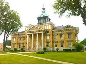
Union County is a county located in the state of Mississippi. Based on the 2010 census, the population was 27,134. Its county seat is New Albany. According to most sources, the county received its name by being a union of pieces of several large counties, like other Union counties in other states. However, other sources say that the name was meant to mark the re-union of Mississippi and the other Confederate states after the Civil War (at the time, the state had a Republican government under Reconstruction) or that the name came from the Union District, South Carolina, where many of the area's first European-American settlers came from. It is possible that there was more than one reason for the name.
Etymology - Origin of Union County Name
Union is named for the Union which was threatened by the American Civil War.
Demographics:
County QuickFacts: CensusBureau Quick Facts
Union County History
Union County, which was established July 7, 1870, during the reconstruction era, was named so because of the
union of Pontotoc and Tippiah Counties. It is situated in the northeastern part of the state between the counties of
Tippiah and Pontotoc, from which it was originally organized. In 1874 part of Lee County was annexed to it, thus making
its present land area of 412 square miles.
Hernando DeSoto supposedly crossed the Tallahatchie River at the present site of New Albany on his first expedition.
A little north of New Albany, the present county seat, was the old Indian trading post of Alberson, called for the first
citizen and trader at the place. Booker Foster and Moses Collins were merchants there in the early days, as were John N.
Wiley, and Powers and Morgan, who manufactured wheat fans here from 1839 to 1844. Moses Collins built a good grist mill
and sawmill in 1840 on the present site of New Albany, and the business of the older settlement soon moved to that
place. Not even a trace of the old village is left. New Albany is on what is known as the "Pontotoc Ridge," the highest
land in the state and has a rich farming country all about it. Wallerville, Blue Springs and Myrtle are other villages
in the county. The streams are the Tallahatchie River, which runs through the center of the county, and its tributary
creeks the Oconitahatchie, Wilhite, Locks, Lappatubba, and Jones; the head streams of the West Fork of the Tombigbee
River take their rise in the eastern part of the county.
In the year 1857 Moses Parker was conducting a school at the old town of Myrtle, two miles south
of the present town of Myrtle, on the line of the Kansas City, Memphis & Birmingham railroad, (St. Louis & San Francisco
System). From an incident of the time, the place was first known as "Candy Hill,"but after the War, when a postoffice
was established here, it took the name of Myrtle. Hill and Murray, and W.C. and B.F. Whittington were merchants in old
Myrtle, and it had an excellent school conducted by Chosen Myers. The advent of the railroad two miles away caused the
removal of the postoffice and business of the old town to the new station of the same name on the railroad. The
postoffice and little store on the old site are now known as "Avanelle."
The first courthouse was a large, frame building, at the west end of Cotton Street. In 1872 a new, two-story brick
courthouse was built on the present courthouse block. The courthouse was destroyed by fire on October 28, 1881. Lost in
the fire were all the county records accumulated since 1870, School Commisser Minutes 1846-59 are availible. A new
courhouse was built in 1882 but was found inadequate for the needs of the county offices so it was demolished and the
cornerstone for a new building was laid September 5, 1908. The present courthouse was completed June 2, 1909.
Geography: Land and Water
As reported by the Census Bureau, the county has a total area of 417 square miles (1,080 km2), of which, 415
square miles (1,076 km2) of it is land and 1 square miles (4 km2) of it (0.35%) is water.
Neighboring Counties
Bordering counties are as follows:
- Benton County & Tippah County (north)
- Prentiss County (east)
- Lee County (southeast)
- Pontotoc County (south)
- Lafayette County (southwest)
- Marshall County (northwest)
Education


Click Image to Enlarge
