


Click Image to Enlarge
Mississippi Counties
There are eighty counties in Mississippi. Two original counties were Adams County and Jefferson County (formerly Pickering) established in 1799Winston County, Mississippi
Winston County Education, Geography, and History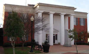
Winston County is a county located in the state of Mississippi. In the 2010 census, the population was 19,198. Its county seat is Louisville. The county is named for Louis Winston (1784-1824), a colonel in the militia, a prominent lawyer, and a judge of the Mississippi Supreme Court.
Etymology - Origin of Winston County Name
Winston is named for military leader Louis Winston.
Demographics:
County QuickFacts: CensusBureau Quick Facts
Winston County History
Winston County was established December 23, 1833, and was one of the numerous counties formed in that year from the territory acquired from the Choctaws, by the treaty of Dancing Rabbit, in 1830. The county has a land surface of 597 square miles. It was named in honor of Colonel Louis Winston (1784-1824), a native of Virginia, who moved to Mississippi Territory and became a prominent lawyer and the colonel of a regiment of militia. In 1809 he was appointed the district attorney general for Madison County, but it appears that he moved to the Natchez District in about 1817. He was the secretary of the Constitutional Convention of 1817, and he served as a judge of the Mississippi Supreme Court from 1821 until his death, on August 20, 1824, at his home in Washington, Mississippi. Winston County, Alabama, was named for his kinsman, John A. Winston, who served as Governor of Alabama from 1853 to 1857.
The original act declared that it should embrace the following territory: Townships 13, 14, 15, and 16 of ranges 10,
11, 12, 13, and 14. By an act of the legislature in 1875, townships 15 and 16, range 10, and township 16, range 11,
were added to Choctaw County and about the same time the north half of sections 2 and 3, township 12, range 13, were
taken from Neshoba County and added to Winston. It is situated in the so-called Yellow Loam Region. Shortly before
and after its organization, a strong tide of emigration set in toward this section of the State from the older parts
of Mississippi, and from the States of Georgia, Alabama and Tennessee, and by the year 1837 the population of the
county was whites 2,193, slaves 959, and by 1840 the population had reached 4,650, including slaves.
Louisville, Incorporated in 1836, is the county seat named for Louis Winston and platted on a tract near the center
of the county, donated by Jesse Dodson. It was on the great mail route from Nashville to New Orleans, and the
terminus of five mail routes in the early days.
Geography: Land and Water
As reported by the Census Bureau, the county has a total area of 610 square miles (1,580 km2), of which, 607 square miles (1,572 km2) of it is land and 3 square miles (8 km2) of it (0.51%) is water.
Neighboring Counties
Bordering counties are as follows:
- Oktibbeha County (north)
- Noxubee County (east)
- Kemper County (southeast)
- Neshoba County (south)
- Attala County (west)
- Choctaw County (northwest)
Education


Click Image to Enlarge
