


Click Image to Enlarge
Missouri Counties
Missouri has one hundred and fourteen counties and one independent city. St. Louis City is separate from St. Louis County and is referred to as a "city not within a county." Following the Louisiana Purchase and the admittance of Louisiana into the United States in 1812, five counties were formed out of the Missouri Territory at the first general assembly. Most subsequent counties were apportioned from these five original counties.Atchison County, Missouri
Atchison County Education, Geography, and History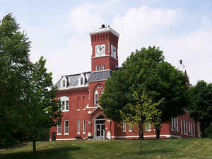
Atchison County is the northwestern-most county in the state of Missouri. As of the 2010 US Census, the county had a population of 5,685. Its county seat is Rock Port. It was originally known as Allen County when it was detached from Holt County in 1843. The county was officially organized on February 14, 1845 and named for US Senator David Rice Atchison from Missouri.
Etymology - Origin of Atchison County Name
Named for David Rice Atchison, United States senator.
Demographics:
County QuickFacts: CensusBureau Quick Facts
History of Atchison County, Missouri
Organized February 14, 1845, from Holt County and The boundaries for Allen County were defined by the legislature in 1843 and attached to Holt County in 1845 and named in honor of David R. Atchison, who was then a senator from Missouri. (SESSION LAWS, 1844-1845, p. 34; Davis & Durrie, p. 316; HIST. HOLT & ATCH. 1882, p. 585; HIST. HARR. 1888, p. 182; BIOG. HIST. ATCH. p. 7; ATCH. CO. MAIL, Aug. 5, 1827, p. 1)
Source: Ewing, Martha K. "Place Names In The Northwest Counties Of Missouri." M.A. thesis., University of Missouri-Columbia, 1929.
Geography: Land and Water
As reported by the Census Bureau, the county has a total area of 550 square miles (1,400 km2), of which 547 square miles (1,420 km2) is
land and 2.8 square miles (7.3 km2) (0.5%) is water.
Atchison's western boundary for the most part is the Missouri River and Nebraska. An 1867 flood straightened a bend in the river north of
Watson. Both Nebraska and Missouri claimed the 5,000 acre McKissick Island that extends almost two miles into Atchison County. The Supreme
Court in 1904 decided that the land belongs to Nebraska. The only way Nebraskans can reach it by road is to cross the Missouri River and then
travel through Missouri
Neighboring Counties
Bordering counties are as follows:
- Fremont County, Iowa (north)
- Page County, Iowa (northeast)
- Nodaway County (east)
- Holt County (south)
- Richardson County, Nebraska (southwest)
- Nemaha County, Nebraska (west)
- Otoe County, Nebraska (northwest)
Education
Public Schools
Fairfax R-III School District - Fairfax
Rock Port R-II School District - Rock Port
Tarkio R-I School District - Tarkio
Private Schools
Tarkso Academy - Tarkio (07-12) - Nonsectarian (All Boys)


Click Image to Enlarge
