


Click Image to Enlarge
Missouri Counties
Missouri has one hundred and fourteen counties and one independent city. St. Louis City is separate from St. Louis County and is referred to as a "city not within a county." Following the Louisiana Purchase and the admittance of Louisiana into the United States in 1812, five counties were formed out of the Missouri Territory at the first general assembly. Most subsequent counties were apportioned from these five original counties.Buchanan County, Missouri
Buchanan County Education, Geography, and History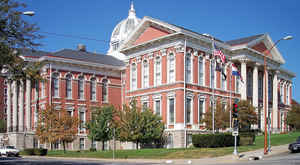
Buchanan County is a county located in the state of Missouri. As of the 2010 US Census, the population was 89,201. Its county seat
is St. Joseph. When originally formed in 1838, the county was named Roberts County, after settler Hiram Roberts; it was renamed in 1839 for
James Buchanan, then a US Senator and later President of the United States. The county was formed from land annexed to Missouri, as were
five other counties.
Buchanan County is included in the St. Joseph, MO-KS Metropolitan Statistical Area.
Etymology - Origin of Buchanan County Name
Named for James Buchanan, senator from Pennsylvania and later United States president.
Demographics:
County QuickFacts: CensusBureau Quick Facts
History of Buchanan County
Buchanan County was organized February 10, 1839, and named in honor of James Buchanan of Pennsylvania, who afterwards became President of the United States. At that time he represented the United States at the Court of St. Petersburg and was a popular idol at home. Formerly the county was known as Roberts County (q.v.). (Eaton, p. 263; Campbell, p. 73-4; HIST. BUCHANAN 1881, p. 152; HIST. BUCHANAN & ST. JOSEPH, 1904, p. 25; BOONVILLE WEEKLY ADV., Nov. 10, 1911, p. 2)
Source: Ewing, Martha K. "Place Names In The Northwest Counties Of Missouri." M.A. thesis., University of Missouri-Columbia, 1929.
Geography: Land and Water
As reported by the Census Bureau, the county has a total area of 415 square miles (1,070 km2), of which 408 square miles (1,060 km2) is
land and 6.6 square miles (17 km2) (1.6%) is water
Neighboring Counties
Bordering counties are as follows:
- Andrew County (north)
- DeKalb County (northeast)
- Clinton County (east)
- Platte County (south)
- Atchison County, Kansas (southwest)
- Doniphan County, Kansas (northwest)
Education
Public schools
Buchanan County R-IV School District - De Kalb
Mid-Buchanan County R-V School District - Faucett
St. Joseph School District - St. Joseph
Private schools
Baptist Temple Schools - St. Joseph (K-12) - Baptist
Cathedral School & Early Childhood Center - St. Joseph (NS/PK-08) - Roman Catholic
Prescott Seventh-day Adventist School - St. Joseph (02-08) - Seventh-day Adventist
St. Francis Xavier School - St. Joseph (K-09) - Roman Catholic
St. James School - St. Joseph (K-09) - Roman Catholic
St. Joseph Christian School - St. Joseph (PK-12) - Nondenominational Christian
St. Paul Lutheran School - St. Joseph (K-09) - Lutheran
St. Joseph KinderCare - St. Joseph (NS-PK)
South Park Christian Academy - St. Joseph (K-12) - Pentecostal
Bishop LeBlond High School - St. Joseph (09-12) - Roman Catholic


Click Image to Enlarge
