


Click Image to Enlarge
Missouri Counties
Missouri has one hundred and fourteen counties and one independent city. St. Louis City is separate from St. Louis County and is referred to as a "city not within a county." Following the Louisiana Purchase and the admittance of Louisiana into the United States in 1812, five counties were formed out of the Missouri Territory at the first general assembly. Most subsequent counties were apportioned from these five original counties.Cass County, Missouri
Cass County Education, Geography, and History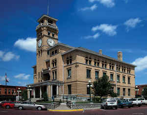
Cass County is a county located in the western part of the state of Missouri. Based on the 2010 census, the population was 99,478. Its
county seat is Harrisonville. The county was organized in 1835 as Van Buren County but was renamed in 1849 after US Senator Lewis Cass of
Michigan who later became a presidential candidate.
Cass County is part of the Kansas City, MO Metropolitan Statistical Area.
Etymology - Origin of Cass County Name
Named for Lewis Cass, Michigan senator and presidential candidate.
Demographics:
County QuickFacts: CensusBureau Quick Facts
History of Cass County (earlier Van Buren County)
Located on the western boundary of the state, with Jackson County on the north, Henry and Johnson Counties on the east, Bates on the south, and Johnson and Miami Counties of Kansas on the west. In the progressive organization of Missouri, the territory now forming Cass County was included in the boundaries of Howard (1816), then in Cooper (1818), then in Lillard (1820), then in Jackson (1825), and finally separated and organized as Van Buren County (q.v.) in 1835. In 1849 the name Van Buren was changed to Cass, in honor of General Lewis Cass (1782-1866). The change was due to political antangonism: in the campaign of 1848, Cass was the Democratic nominee for President, running against Van Buren; and the General Assembly of Missouri was strongly Democratic. In 1851, Cass County was diminished in size by the cutting off of Bates County (q.v.). (HIST. CASS & BATES (1883), 91-94)
Source: Johnson, Bernice E. "Place Names In Six Of The West Central Counties Of Missouri." M.A. thesis., University of Missouri-Columbia, 1933.
Geography: Land and Water
As reported by the Census Bureau, the county has a total area of 702 square miles (1,820 km2), of which 697 square miles (1,810 km2) is
land and 5.7 square miles (15 km2) (0.8%) is water
Neighboring Counties
Bordering counties are as follows:
- Jackson County (north)
- Johnson County (east)
- Henry County (southeast)
- Bates County (south)
- Miami County, Kansas (west)
- Johnson County, Kansas (northwest)
Education
Public schools
Archie R-V School District - Archie
Belton School District No. 124 - Belton
Drexel R-IV School District - Drexel
East Lynne School District No. 40 - East Lynne
Harrisonville R-IX School District - Harrisonville
Midway R-I School District - Cleveland
Pleasant Hill R-III School District - Pleasant Hill
Raymore-Peculiar R-II School District - Peculiar
Sherwood Cass R-VIII School District - Creighton
Strasburg C-3 School District - Strasburg
Private schools
Hope Baptist Christian School - Pleasant Hill (01-12) - Baptist
Harrisonville Christian School - Harrisonville (PK-08) - Nondenominational Christian
Training Center Christian School - Garden City (PK-12) - Pentecostal
Heartland High School & Academy - Belton (PK-12) - Baptist


Click Image to Enlarge
