


Click Image to Enlarge
Missouri Counties
Missouri has one hundred and fourteen counties and one independent city. St. Louis City is separate from St. Louis County and is referred to as a "city not within a county." Following the Louisiana Purchase and the admittance of Louisiana into the United States in 1812, five counties were formed out of the Missouri Territory at the first general assembly. Most subsequent counties were apportioned from these five original counties.Chariton County, Missouri
Chariton County Education, Geography, and History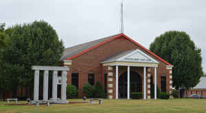
Chariton County is a county located in the North Central portion of the state of Missouri. Based on the 2010 census, the population was 7,831. Its county seat is Keytesville. The county was organized November 16, 1820, from part of Howard County and is named for the Chariton River.
Etymology - Origin of Chariton County Name
Several origins of the name of the Chariton River have been suggested. The most plausible suggestion connects the name of the river with Joseph Chorette, a French fur trader of St. Louis. Trudeau, in his Journal of 1795, mentions Chorette as accompanying him on his expedition up the Missouri River and as being drowned on July 10 of that year while swimming in the river. The family name has the variants Choret, Care and Carrette in old documents.
Demographics:
County QuickFacts: CensusBureau Quick Facts
History of Chariton County
Chariton County was organized on November 16, 1820. At the time of the organization of Chariton County, all the territory now embraced in the counties of Linn, Sullivan, Putnam and a part of Adair and Schuyler, were part of its boundaries. The county seat was established at the town of Chariton situated in the southern part of the county near the mouth of the two rivers by the same name, which stream was called after some French fur traders, who had a fur agency at this point. Just when they made the settlement is unknown, but it is certain they were here as early as 1804. The county was named for the town of Chariton which was laid out in 1817 and located near the mouth of the river of the same name. (Eaton, p. 274; HIST. HOWARD & CHARITON, pp. 405-5; Smith & Gehrig, pp. 209-11; RECORD OF CHARITON, Part I, p. 13, Part II, p. 3)
Source: Adams, Orvyl Guy. "Place Names In The North Central Counties Of Missouri." M.A. thesis., University of Missouri-Columbia, 1928.
Geography: Land and Water
As reported by the Census Bureau, the county has a total area of 767 square miles (1,990 km2), of which 751 square miles (1,950 km2) is
land and 16 square miles (41 km2) (2.0%) is water.
Neighboring Counties
Bordering counties are as follows:
- Linn County (north)
- Macon County (northeast)
- Randolph County (east)
- Howard County (southeast)
- Saline County (southwest)
- Carroll County (west)
- Livingston County (northwest)
Education
Public schools
Brunswick R-II School District - Brunswick
Keytesville R-III School District - Keytesville
Northwestern R-I School District - Mendon
Salisbury R-IV School District - Salisbury
Private schools
St. Joseph School Salisbury (K-09) Roman Catholic


Click Image to Enlarge
