


Click Image to Enlarge
Missouri Counties
Missouri has one hundred and fourteen counties and one independent city. St. Louis City is separate from St. Louis County and is referred to as a "city not within a county." Following the Louisiana Purchase and the admittance of Louisiana into the United States in 1812, five counties were formed out of the Missouri Territory at the first general assembly. Most subsequent counties were apportioned from these five original counties.Maries County, Missouri
Maries County Education, Geography, and History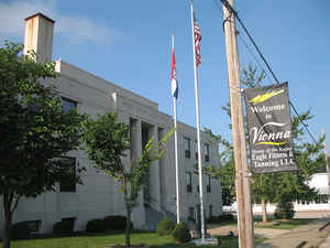
Maries County is a county located in the state of Missouri. Based on the 2010 census, the population was 9,176. Its county seat is Vienna. The county was organized March 2, 1855 and named for the Maries River and Little Maries River. 'Maries' is derived from the French marais, which means marsh, lake or pond.
Etymology - Origin of Maries County Name
Named for the Maries River. Maries is probably a corruption of the French "marias" meaning "marsh" or "swamp." The Maries River, like the upper reaches of the Osage River, was once said to be called Le Marias de Cygnes or "Marsh of Swans." It has also been suggested that the Big and Little Maries Rivers were named for two French girls and that the name is the plural of Marie.
Demographics:
County QuickFacts: CensusBureau Quick Facts
History of Maries County
Maries County was originally a part of St. Louis County. On December 11, 1818, it became part of Franklin County and so remained until November 25, 1820, when it was joined to Gasconade County. When Pulaski County was formed in 1833, it included part of Maries, and the rest remained in Gasconade until Osage County was created in 1841 including part of Maries County. Maries County was organized March 2, 1855. On the north is Osage County; on the west Miller; on the south, Pulaski; on the south and east, Phelps; on the east, Gasconade. The county is named for the two streams which head in it, the Maries River and the Little Maries (q.v.). (HIST. COLE etc., 593, 595)
Source: Weber, Frank. "Place Names Of Six South Central Counties of Missouri." M.A. thesis., University of Missouri-Columbia, 1938.
Geography: Land and Water
As reported by the Census Bureau, the county has a total area of 530 square miles (1,400 km2), of which 527 square miles (1,360 km2) is land and 2.9 square miles (7.5 km2) (0.6%) is water.
Neighboring Counties
Bordering counties are as follows:
- Osage County (north)
- Gasconade County (northeast)
- Phelps County (southeast)
- Pulaski County (southwest)
- Miller County (west)
Education
Public schools
Maries County R-I School District - Vienna
Maries County R-II School District - Belle
Private schools
Visitation Inter-Parish School - Vienna (K-08) - Roman Catholic


Click Image to Enlarge
