


Click Image to Enlarge
Missouri Counties
Missouri has one hundred and fourteen counties and one independent city. St. Louis City is separate from St. Louis County and is referred to as a "city not within a county." Following the Louisiana Purchase and the admittance of Louisiana into the United States in 1812, five counties were formed out of the Missouri Territory at the first general assembly. Most subsequent counties were apportioned from these five original counties.Mississippi County, Missouri
Mississippi County Education, Geography, and History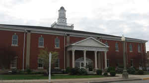
Mississippi County is a county located in the Bootheel of the state of Missouri, with its eastern border formed by the Mississippi River. Based on the 2010 census, the population was 14,358. The largest city and county seat is Charleston. The county was officially organized on February 14, 1845, and was named after the Mississippi River
Etymology - Origin of Mississippi County Name
Named for the Mississippi River. Mississippi is derived from the Algonquin Indian words: missi meaning "great" and seepee meaning "water."
Demographics:
County QuickFacts: CensusBureau Quick Facts
History of Mississippi County
A county on the Mississippi River created by the state legislature February 14, 1845, the territory being cut off from the southern part of Scott County. Charleston was selected as the county seat and the boundaries of the townships of Tywappity, St. James and St. James Bayou, which had belonged to Scott County, were changed and two new townships, Mississippi and Wolf Island were created. Ohio Township was created from Mississippi Township in 1847. The county was named from the Mississippi River (q.v.) (Douglass I 311, M.H.R. 11:330-331)
Source: Hamlett, Mayme L. "Place Names Of Six Southeast Counties Of Missouri." M.A. thesis., University of Missouri-Columbia, 1938.
Geography: Land and Water
As reported by the Census Bureau, the county has a total area of 429 square miles (1,110 km2), of which 412 square miles (1,070 km2) is
land and 17 square miles (44 km2) (4.0%) is water.
Neighboring Counties
Bordering counties are as follows:
- Alexander County, Illinois (north)
- Ballard County, Kentucky (northeast across the Mississippi River)
- Carlisle County, Kentucky (east across the river)
- Hickman County, Kentucky (southeast across the river)
- Fulton County, Kentucky (south across the river)
- New Madrid County (southwest)
- Scott County (northwest)
Education
Of adults 25 years of age and older in Mississippi County, 61.1% possesses a high school diploma or higher while 9.6% holds a bachelor's degree or higher as their highest educational attainment.
Public schools
Charleston R-I School District - Charleston
East Prairie R-II School District - East Prairie
Private schools
St. Henry's School - Charleston - (01-08) - Roman Catholic


Click Image to Enlarge
