


Click Image to Enlarge
Missouri Counties
Missouri has one hundred and fourteen counties and one independent city. St. Louis City is separate from St. Louis County and is referred to as a "city not within a county." Following the Louisiana Purchase and the admittance of Louisiana into the United States in 1812, five counties were formed out of the Missouri Territory at the first general assembly. Most subsequent counties were apportioned from these five original counties.Moniteau County, Missouri
Moniteau County Education, Geography, and History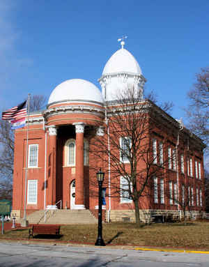
Moniteau County is a county located in the state of Missouri. Based on the 2010 census, the population was 15,607.Its county seat is
California. The county was organized February 14, 1845 and named for the Moniteau Creek. 'Moniteau' is a French spelling of Manitou, Algonquian
for the Great Spirit.
Moniteau County is part of the Jefferson City, MO Metropolitan Statistical Area.
Etymology - Origin of Moniteau County Name
Named for Moniteau Creek. The name Moniteau is the French spelling of the Indian word meaning "spirit of God." It has been said that the creek was named by the Indians for the painted figure of a man "spirit of God," that was on a rock at the mouth.
Demographics:
County QuickFacts: CensusBureau Quick Facts
History of Moniteau County
Moniteau County was organized February 14, 1845. It was named for the creek which flows through it (q.v.). "The present spelling dates from 1821 when the Cole County Court established Moniteau Township, the orthography being their own for manito or manitou." (HIST. COLE, MONITEAU, p. 310, Campbell, p. 66, Gannett, p. 212)
Source: Pace, Nadine. "Place Names In The Central Counties Of Missouri." M.A. thesis., University of Missouri-Columbia, 1928.
Geography: Land and Water
As reported by the Census Bureau, the county has a total area of 419 square miles (1,090 km2), of which 415 square miles (1,070 km2) is
land and 3.8 square miles (9.8 km2) (0.9%) is water.
Neighboring Counties
Bordering counties are as follows:
- Cooper County (northwest)
- Boone County (northeast)
- Cole County (southeast)
- Miller County (south)
- Morgan County (southwest)
Education
Public schools
Clarksburg C-2 School District - Clarksburg
High Point R-III School District - High Point
Jamestown C-1 School District - Jamestown
Moniteau County R-I School District - California
Moniteau County R-V School District - Latham
Private schools
California Christian Academy - California (02-07) - Nondenominational Christian
Hazel Dell School - Latham (02-09) - Mennonite
Prairie Union School - Latham (02-09) - Mennonite
South Latham School - Latham (01-08) - Mennonite
St. Andrew School - Tipton (K-09) - Roman Catholic


Click Image to Enlarge
