


Click Image to Enlarge
Missouri Counties
Missouri has one hundred and fourteen counties and one independent city. St. Louis City is separate from St. Louis County and is referred to as a "city not within a county." Following the Louisiana Purchase and the admittance of Louisiana into the United States in 1812, five counties were formed out of the Missouri Territory at the first general assembly. Most subsequent counties were apportioned from these five original counties.Pulaski County, Missouri
Pulaski County Education, Geography, and History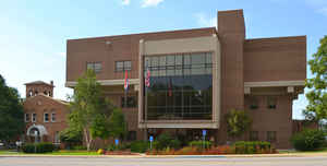
Pulaski County is a county located in the state of Missouri. Based on the 2010 census, the population was 52,274. Its county seat is
Waynesville. The county was organized in 1833 and named for Kazimierz Pułaski, a Polish patriot who died fighting in the American Revolution.
Pulaski County is the site of Fort Leonard Wood, a US Army installation base. It comprises the Fort Leonard Wood, MO Micropolitan
Statistical Area.
Etymology - Origin of Pulaski County Name
Named for Casmir Pulaski, Polish general of the American Revolution.
Demographics:
County QuickFacts: CensusBureau Quick Facts
History of Pulaski County
Organized by act of legislature Janurary 19, 1833. On the north are Miller and Maries Counties, on the east is Phelps, on the south are Texas and Laclede, on the west are Laclede and Camden. It has been called "the mother of counties" because Phelps entirely, and parts of Crawford, Camden, Miller, Maries, and Texas Counties were formed from it. It was named for Count Casimir Pulaski, the Polish patriot, who fought for the American colonies in the Revolutionary War and was killed at the Battle of Savannah. Pulaski is a stock name found in six other counties and eleven towns. It has also been called "The Switzerland of America" because of its high hill, bluffs, and swift rivers. (LAWS OF MISSOURI 1833; HIST. LACLEDE, 113; OZARK REGION & PEOPLE, 70; G.M. Reed; G.W. Lane)
Source: Weber, Frank. "Place Names Of Six South Central Counties of Missouri." M.A. thesis., University of Missouri-Columbia, 1938.
Geography: Land and Water
As reported by the Census Bureau, the county has a total area of 551 square miles (1,430 km2), of which 547 square miles (1,420 km2) is
land and 4.4 square miles (11 km2) (0.8%) is water.
Neighboring Counties
Bordering counties are as follows:
- Miller County (northwest)
- Maries County (northeast)
- Phelps County (east)
- Texas County (south)
- Laclede County (southwest)
- Camden County (west)
Education
Public schools
Crocker R-II School District - Crocker
Dixon R-I School District - Dixon
Laquey R-V School District - Laquey
Swedeborg R-VIII School District - Swedeborg
Richland R-IV School District - Richland
Waynesville R-VI School District - Waynesville
Private schools
Maranatha Baptist Academy - St. Robert (K4-12) - Baptist


Click Image to Enlarge
