


Click Image to Enlarge
Missouri Counties
Missouri has one hundred and fourteen counties and one independent city. St. Louis City is separate from St. Louis County and is referred to as a "city not within a county." Following the Louisiana Purchase and the admittance of Louisiana into the United States in 1812, five counties were formed out of the Missouri Territory at the first general assembly. Most subsequent counties were apportioned from these five original counties.Randolph County, Missouri
Randolph County Education, Geography, and History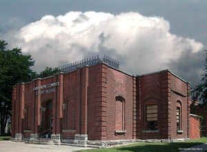
Randolph County is a county located in the northern portion of the state of Missouri. Based on the 2010 census, the population was
25,414. Its county seat is Huntsville. The county was organized January 22, 1829 and named for US Representative and US Senator John
Randolph of Roanoke of Virginia.
Randolph County comprises the Moberly, MO Micropolitan Statistical Area, which is also included in the Columbia-Moberly-Mexico, MO Combined
Statistical Area.
Etymology - Origin of Randolph County Name
Named for John Randolph of Virginia.
Demographics:
County QuickFacts: CensusBureau Quick Facts
History of Randolph County
Originally a part of Howard County. Organized as a separate county on January 22, 1829. It is bounded on the north by Macon County, on the east by Audrain and Monroe, on the south by Boone and Howard, and on the west by Chariton County. It was named for John Randolph of Roanoke, Virginia, an orator and statesman of renown. Randolph was born in Chesterfield, Virginia, June 2, 1773, and died in Philadelphia, June 24, 1833. He was educated at Princeton and Columbia Universities. Besides being a member of the House of Representatives for several terms, beginning in 1799, he was also a United States Senator and a minister to Russia. (HIST. RANDOLPH, 96, 121 f., STATE LAWS, FIRST SESSION 5TH GENERAL ASSEMBLY, 42-44; J.D. Hammett, E.M. Richmond)
Source: Leech, Esther. "Place Names Of Six East Central Counties Of Missouri." M.A. thesis., University of Missouri-Columbia, 1933.
Geography: Land and Water
As reported by the Census Bureau, the county has a total area of 488 square miles (1,260 km2), of which 483 square miles (1,250 km2) is
land and 5.1 square miles (13 km2) (1.1%) is water.
Neighboring Counties
Bordering counties are as follows:
- Macon County (north)
- Monroe County (east)
- Shelby County (northeast)
- Audrain County (southeast)
- Boone County (southeast)
- Howard County (south)
- Chariton County (west)
Education
Public schools
Higbee R-VIII School District - Higbee
Moberly School District - Moberly
Northeast Randolph County R-IV School District - Cairo
Renick R-V School District - Renick
Westran R-I School District - Huntsville
Private schools
St. Pius X Elementary School - Moberly (PK-08) - Roman Catholic
Maranatha Seventh-day Adventist School - Moberly (K-09) - Seventh-day Adventist
Post-secondary
Central Christian College of the Bible - Moberly - A private, four-year Christian Churches and Churches of Christ university.
Moberly Area Community College - Moberly - A public, two-year community college.


Click Image to Enlarge
