


Click Image to Enlarge
Nebraska Counties
There is ninety-three counties in state of Nebraska. Despite the fact that Sarpy County contained the oldest settlement in the state, it was one of the last lands along the river to be recognized by law. Finally, on February 1, 1857, the land "where the cities meet the country" was officially created.Thayer County, Nebraska
Thayer County Education, Geography, and History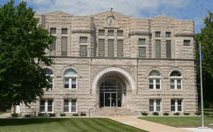
Thayer County is a county located in the state of Nebraska. Based on the 2010 census, the population was 5,228. Its county seat is Hebron. The county was created in 1856 and originally named Jefferson County. It was later organized in 1870-1871 and renamed for the General and Governor John Milton Thayer
Etymology - Origin of Thayer County Name
Jefferson and Jones Counties were united to become one, under the Jefferson name. Then in 1870 the Legislature once again separated the two. What was originally called Jones took the name Jefferson and retained the old county records. The initial Jefferson became known as Thayer, in honor of Gen. John Milton Thayer, a US senator from Nebraska and later its governor.
Demographics:
County QuickFacts: CensusBureau Quick Facts
County History
The area that is known today as
Thayer County was first established by the Territorial Legislature in 1856. It
would be another 14 years before it would become known as Thayer County,
however.
Legislators originally designated the area as Jefferson County, while the
present Jefferson County, neighboring to the east, was designated as Jones
County. In 1867, when Nebraska was admitted to the Union, Jefferson and Jones
Counties were united to become one, under the Jefferson name. Then in 1870 the
Legislature once again separated the two. What was originally called Jones took
the name Jefferson and retained the old county records. The initial Jefferson
became known as Thayer, in honor of Gen. John Milton Thayer, a US senator from
Nebraska and later its governor.
The early development of the area was attributed to the great trail period.
Nearly 2-1/2 decades before it became Thayer County, the area was crossed by the
Oregon Trail and the Pony Express Route. This brought thousands of immigrants
through the area and caused the Indians to fear the white man was taking over
their cherished hunting grounds. A number of fierce raids and battles took place
between 1864 and 1867.
An 1869 circular promoting the colonization of this area resulted in scores of
settlers rushing in to file for homesteads. The circular falsely claimed,
however, that factories, mills, railroads and flourishing towns awaited for
them. None of these conditions actually existed.
When the St. Joseph and Western Railroad built through northern Thayer County in
1872 and the Burlington and Missouri River Railroad crossed the southern portion
of the county, new growth resulted. Hebron, first surveyed three years earlier,
was named the county seat.
Hardships have not been uncommon in this area. Grasshoppers, drought, prairie
fires and blizzards hampered early settlers. But one of the most devastating
hardships occurred in 1953 when a tornado tore through Hebron, damaging
everything in its path, including more than $70,000 damage to the courthouse.
Geography: Land and Water
As reported by the Census Bureau, the county has a total area of 575 square miles (1,490 km2), of which 574 square miles (1,490 km2) is land
and 1.2 square miles (3.1 km2) (0.2%) is water
Neighboring Counties
Bordering counties are as follows:
- Jefferson County (east)
- Washington County, Kansas (southeast)
- Republic County, Kansas (south)
- Nuckolls County (west)
- Fillmore County (north)
Education


Click Image to Enlarge
