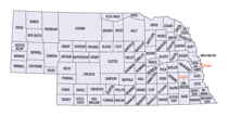
Nebraska Counties
There is ninety-three counties in state of Nebraska. Despite the fact that Sarpy County contained the oldest settlement in the state, it was one of the last lands along the river to be recognized by law. Finally, on February 1, 1857, the land "where the cities meet the country" was officially created.Thomas County, Nebraska
Thomas County Education, Geography, and History
Thomas County is a county located in the state of Nebraska. Based on the 2010 census, the population was 647. Its county seat is Thedford. The county was formed in 1887 and named after General George H. Thomas.
Etymology - Origin of Thomas County Name
name the area after Civil War Gen. George H. Thomas.
Demographics:
County QuickFacts: CensusBureau Quick Facts
Thomas County History
Thomas County's early development can
be tied directly to the westward advancement of the railroad. As a result, the
county's early history dates back only to the 1880s.
The first homestead claim in this area was filed in 1880. It would be seven
years later before the Nebraska Legislature would create the county's boundaries
and name the area after Civil War Gen. George H. Thomas.
Prior to the county being organized, this area in the heart of the Nebraska
Sandhills was primarily open range pasture land used by cattlemen who brought
their herds north from Texas to sell to the government. The government used the
beef to feed the Indian reservations in South Dakota.
But it was the railroad which played the most prominent role in the county's
development as it followed the Loup River. By the mid to late 1880s the Chicago,
Burlington and Quincy line stretched from the county's east to west boundaries.
Along the route the railroad designated five stations: Norway, Natick, Halsey,
Thedford and Seneca. The latter three eventually became the county's only
settlements.
Thedford was designated as the county seat when the county was organized. In
1887, the year the railroad line reached the settlement, a post office opened.
About the same time the county's first courthouse was built. It would be
replaced in 1922 by the present courthouse.
Passage of the Kinkaid Act in 1904 had a big impact on Thomas County. In the
1890 census, only 517 residents were reported. With the Kinkaid Act many new
settlers came to the area in hopes of farming the 640 acres of land they
received. The county's all-time high population of 1,773 residents was recorded
in 1920. But since the region was not conducive to farming, many of these "Kinkaiders"
left the area by 1930. Those who remained bought the abandoned homesteads and
created large ranches. In 1940, 14 ranches were said to contain nearly 3,500
acres each.
In addition to large cattle ranches, Thomas County is also home to the Nebraska
National Forest located between the Loup and Dismal Rivers.
Geography: Land and Water
As reported by the Census Bureau, the county has a total area of 714 square miles (1,850 km2), of which 713 square miles (1,850 km2) is
land and 0.8 square miles (2.1 km2) (0.1%) is water.
Neighboring Counties
Bordering counties are as follows:
- Cherry County - north
- Blaine County - east
- Logan County - south
- McPherson County - southwest
- Hooker County - west
Education


