

Click Image to Enlarge
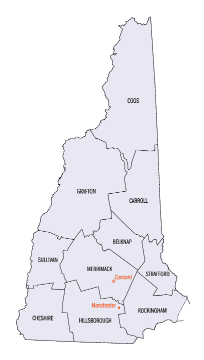
New Hampshire Counties
There are currently ten Counties in the state of New Hampshire. Five of the counties were created in 1769, when New Hampshire was still an English colony and not a state, during the first subdivision of the state into counties. The last counties created were Belknap County and Carroll County, in 1840.Merrimack County, New Hampshire
Merrimack County Education, Geography, and History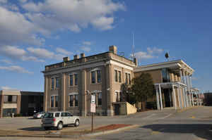
Merrimack County is a county in the state of New Hampshire. Based on the 2010 census, the population was 146,445, making it the
third-most populous county in New Hampshire. Its county seat is Concord, the state capital. The county was organized in 1823 from parts of
Hillsborough and Rockingham counties, and is named for the Merrimack River.
Merrimack County comprises the Concord, NH Micropolitan Statistical Area, which is also included in the Boston-Worcester-Providence,
MA-RI-NH-CT Combined Statistical Area.
Etymology - Origin of Merrimack County Name
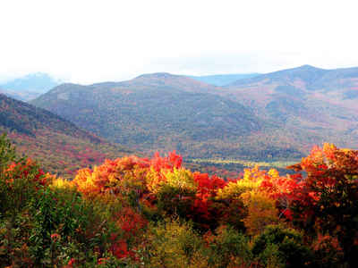
The county was named for The Merrimack River. The Merrimack River (or Merrimac River, an earlier spelling that is sometimes still used) is a 110-mile (177 km)-long river in the northeastern United States. It rises at the confluence of the Pemigewasset and Winnipesaukee rivers in Franklin, New Hampshire, flows southward into Massachusetts, and then flows northeast until it empties into the Atlantic Ocean at Newburyport. From the point where the Merrimack turns northeast in Lowell, Massachusetts onward, the Massachusetts-New Hampshire border is roughly calculated as the line three miles north of the river.
Demographics:
County QuickFacts: CensusBureau Quick Facts
Merrimack County History
Concord, the capital of New Hampshire, covers an area of 64 square miles and has a population of approximately 34,500 people. The political heart of the state, Concord began as a small unnamed trading post in 1659 along the Merrimack River. A bend in the
river named Penny Cook by the Indians was the site in 1697 of Hannah Dustin's famous escape from Indian captors. Kidnaped on a raid of Haverhill, MA Hannan Dustin scalped her sleeping captors and escaped.
Settlers increased in the region and the land was granted in 1725 and named the Plantation of Penacook. In 1733, it became the town of Rumford, and in 1765 Governor Wentworth granted the name Concord for the town.
The town grew and by 1775 there was a population of 1,052. Timothy Walker made sure the convention on ratification of the US Constitution was held in Concord and he was instrumental in obtaining that ratification in 1788.
Throughout the 1780's state government met in various locations in NH including Concord. Its central location made it an ideal spot for permanent government and in 1808, Concord became the capital. The State House was completed in 1819 and has since remained the meeting site of the largest
legislature in the United States.
Concord continued to grow and become a trade center. Several industries sprang up and in later years Concord granite was used to construct buildings throughout New England and the East.
Concord is also famous as the home of the Concord Coach. In 1827 Lewis Downing, a wheelwright, and J. Stephen Abbot, a journeyman coach builder, completed the first Concord Coach. Together they manufactured 40 styles of commercial and pleasure vehicles as well as 14 styles of Concord Coach.
The coaches were brightly colored with elaborate trim and yellow gear. Over the next century the company produced 3,000 coaches, each weighing some 2,400 pounds costing between $775-$1,250. Concord Coaches, used by Wells Fargo, opened the American West.
Several famous individuals either lived in or spent time in Concord, including 14th President Franklin Pierce, Daniel Webster, Horace Greeley, John Parker Hale, and George Hamilton Perking.
Geography: Land and Water
As reported by the Census Bureau, the county has a total area of 956 square miles (2,476 km2), of which 934 sq mi (2,419 km2) is land and 22 sq mi (57 km2) (2.31%) is water.
Neighboring Counties
Bordering counties are as follows:
- Belknap County (northeast)
- Strafford County (east)
- Rockingham County (southeast)
- Hillsborough County (south)
- Sullivan County (west)
- Grafton County (northwest)
Education


Click Image to Enlarge
