

Click Image to Enlarge
New Jersey Counties
New Jersey has twenty-one counties. New Jersey's first counties were created as administrative districts within each province, with East Jersey split in 1675 into Bergen, Essex, Middlesex and Monmouth counties, while West Jersey's initial counties of Burlington and Salem date to 1681. The most recent county created in New Jersey was Union County, created in 1857.Cape May County, New Jersey
Cape May County Education, Geography, and History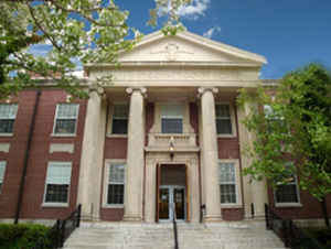
Cape May County is the southernmost county in the state of New Jersey. Based on the 2010 census, the population was 97,265.
The county was named for Cornelius Jacobsen Mey, a Dutch captain who explored and charted the area from 1611 to 1614, and established a claim
for the province of New Netherland.
The county is part of the Ocean City, NJ Metropolitan Statistical Area as well as the Philadelphia-Reading-Camden, PA-NJ-DE-MD Combined
Statistical Area. Its county seat is the Cape May Court House section of Middle Township
Etymology - Origin of Cape May County Name
Cape May is named for Cape May, Capt. Cornelius Jacobsen Mey.
Demographics:
County QuickFacts: CensusBureau Quick Facts
Cape May County History
The first people to live in what would become Cape May County were the Lenni Lenapes, a sub-tribe of the Algonquins or the Delawares. It
has been debated whether the Lenni Lenapes only summered in Cape May County or lived here year around, but it is known that they hunted and
fished along the shore. By the 17th century there were two sub-divisions o f the Lenni Lenapes, the Tuckahoes who lived along the Tuckahoes
River and the Kechemeches, who were found between Cape May Court House and Cape May Point. It is reported that contact with the Europeans was
peaceful and friendly, but due to shrinking numbers many of the remaining Natives moved away by 1735.
Henry Hudson sailed up the Delaware River on the Half Moon in 1609. Although he anchored near Cape May Point and explored the area, there was
never an attempt to settle the land. In 1622 Cornelius Jacobsen Mey sailed for the Dutch aboard the Glad Tiding to the Delaware Bay and New
York. He never set foot on the land, but he named the south cape, Cape Cornelius (now Cape Henlopen in Delaware) and the north cape, Cape Mey.
Later, English settlers changed the spelling to Cape May. Sir George Carteret, a governor of New Jersey, named the land New Jersey because
Carteret had been the governor of the Isle of Jersey in the English Channel.
In approximately 1685, the first permanent settlement was established. The abundance of whales in the Delaware Bay attracted Mayflower
descendants from the North (After Massachusetts, Cape May County has the second largest number of Mayflower descendants).
Their settlement was constructed on the banks of the Delaware River in Portsmouth (New England Village) or what is today called Townbank.
Nothing remains of the first settlement because the land has been eroded away by the bay.
Cape May County was created in 1692 from land held by the West Jersey Society. Ferry service across Great Egg Harbor was established the following year.
County
12 Nov 1692 from Cumberland County.
Boundary Changes
1685, court set up
1692, county given boundaries in West Jersey
1694, boundaries changed to transfer Great Egg Harbor area to Gloucester County
1710, boundary changed
1822, boundary with Cumberland County clarified
1844, part of Cumberland County added
1845, the 1844 part of Cumberland County returned
1846, coastal boundary established
1878, part of Maurice River twp., Cumberland County, added to Upper twp.
1891, part of Maurice River twp., Cumberland County, added to Dennis twp.
1906, coastal boundary established.
Geography: Land and Water
Most of the county lies on a peninsula that juts into Delaware Bay. It is flat and coastal. Sea level is the lowest point; the highest
elevation is found at three areas in Belleplain State Forest in the county's northern corner which are approximately 60 feet (18 m) above sea
level.
According to the 2010 Census, the county had a total area of 620.42 square miles (1,606.9 km2), including 251.42 square miles (651.2 km2) of
land (40.5%) and 368.99 square miles (955.7 km2) of water (59.5%)
Neighboring Counties
Bordering counties are as follows:
- Atlantic County, New Jersey - north
- Cumberland County, New Jersey - northwest
- Kent County, Delaware - west1
- Sussex County, Delaware - southwest1
1 across Delaware Bay; no land border
Education
Atlantic Cape Community College, founded in 1964 with campuses in Mays Landing and Cape May Court House, serves students from both Atlantic County and Cape May County. Rutgers University has a partnership with Atlantic Cape Community College which offers bachelor's degree completion programs at Atlantic Cape's Mays Landing campus.


Click Image to Enlarge
