


Click Image to Enlarge
New York Counties
There are sixty-two counties in the State of New York. The first twelve counties in New York were created immediately after the British annexation of the Dutch colony of New Amsterdam, although two of these counties have since been abolished. The most recent county formation in New York was in 1912, when Bronx County was created from the portions of New York City that had been annexed from Westchester County.Cattaraugus County, New York
Cattaraugus County Education, Geography, and History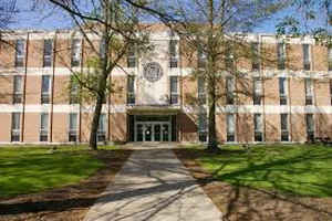
Cattaraugus County is a county located in the western part of the state of New York, with one side bordering Pennsylvania. Based on the 2010 census, the population was 80,317. The county seat is Little Valley. The county was created in 1808 and later organized in 1817.
Cattaraugus County comprises the Olean, NY Micropolitan Statistical Area, which is included in the Buffalo-Cheektowaga, NY Combined
Statistical Area
Etymology - Origin of Cattaraugus County Name
from a Seneca Indian word meaning "bad smelling banks," referring to the odor of natural gas leaking from rock seams
Demographics:
County QuickFacts: CensusBureau Quick Facts
Cattaraugus County History
The newly independent United States sought to extinguish native reserves after the British ceded their territory east of the Mississippi River and south of the Great Lakes to the United States. This included Iroquois territory in New York; the four nations that had been allies of the British mostly relocated to Ontario, where the Crown gave them land grants in some compensation for losses. The Treaty of Canandaigua, in 1794, extinguished what was left of native title, with the exception of several reservations, two of which were at least partially located in what is now Cattaraugus County.
Ontario County was split from Montgomery County in 1789 as a result of the establishment of the Morris
Reserve. In turn, Genesee County was split from Ontario County in 1802 as a result of the Holland Purchase. This period was the beginning of
more significant European-American settlement of this western territory. Shortly afterward, Genesee County was reduced in 1806 by the creation
of Allegany County.
Cattaraugus County was formed in 1808, split off from Genesee County. At first there was no county government due to the sparse population.
From 1812 to 1814, Cattaraugus County was incorporated in Allegany County; from 1814 to 1817, records of the county were divided between
Belmont (Allegany County) and Buffalo (then in Niagara County). The name "Cattaraugus" derives from a Seneca word for "bad smelling banks,"
and was named for the "odor of natural gas leaking from rock seams." In 1817, a county government was established for Cattaraugus County in
the southwestern corner of the town of Hebe, now Ellicottville.
Numerous towns in the county are named after agents of the Holland Land Company, including Ellicottville (Joseph Ellicott), Franklinville
(William Temple Franklin, a speculator and grandson of Benjamin Franklin), and Otto and East Otto (Jacob Otto). The first settlement in the
county was in Olean. After 1860, the county seat was moved to Little Valley.
Cattaraugus County is in the southwest part of New York State. Eric County bounds it on the north, Allegany to the east, Chautauqua to the west, and the counties of McKean and Warren in Pennsylvania are on the south. Cattaraugus County was formed from Genesee County on March 11, 1808, but the county did not have a Board of Supervisors and the courts until 1817 when the county had the required 500 voters to elect a member for the New York State Assembly.
Geography: Land and Water
Cattaraugus County is in the southwestern part of the state, immediately north of the Pennsylvania border. The
southern part of Cattaraugus County is the only area of western New York that was not covered by the last ice age
glaciation and is noticeably more rugged than neighboring areas that had peaks rounded and valleys filled by the
glacier. The entire area is actually a dissected plateau of Pennsylvanian and Mississippian age, but appears
mountainous to the casual observer. The plateau is an extension of the Allegany Plateau from nearby Pennsylvania.
Southern Cattaraugus County is part of the same oil field, and petroleum was formerly a resource of the area. It is
now mostly played out, but natural gas continues to be extracted.
A continental divide between the Mississippi River and Great Lakes watersheds runs through Cattaraugus County
As reported by the Census Bureau, the county has a total area of 1,322 square miles (3,425 km2), of which, 1,310
square miles (3,392 km2) of it is land and 12 square miles (32 km2) of it (0.94%) is water.
The northern border of the county is formed by Cattaraugus Creek.
Neighboring Counties
Bordering counties are as follows:
- Erie County, New York - north
- Wyoming County, New York - northeast
- Allegany County, New York - east
- McKean County, Pennsylvania - southeast
- Warren County, Pennsylvania - southwest
- Chautauqua County, New York - west
Education
A branch of Jamestown Community College, in Olean provides higher education for residents. Olean Business Institute provided specialized education and is also in Olean; it closed in 2013 due to financial and enrollment declines. Jamestown Business College operates a satellite campus in Salamanca. Cornplanter College, a tribally controlled college, opened in 2014 in Salamanca. St. Bonaventure University is located in its own census-designated place just west of Olean.


Click Image to Enlarge
