


Click Image to Enlarge
New York Counties
There are sixty-two counties in the State of New York. The first twelve counties in New York were created immediately after the British annexation of the Dutch colony of New Amsterdam, although two of these counties have since been abolished. The most recent county formation in New York was in 1912, when Bronx County was created from the portions of New York City that had been annexed from Westchester County.Montgomery County, New York
Montgomery County Education, Geography, and History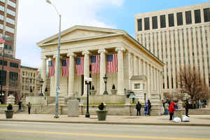
Montgomery County is a county located in the state of New York. Based on the 2010 census, the population was 50,219. The county seat is
Fonda. The county was named in honor of Richard Montgomery, an American Revolutionary War general killed in 1775 at the Battle of Quebec. It
was created in 1772 as Tryon County and in 1784 was renamed Montgomery County.
Montgomery County comprises the Amsterdam, NY Micropolitan Statistical Area. The county borders the north and south banks of the Mohawk River.
Etymology - Origin of Montgomery County Name
Named in honor of Major General Richard Montgomery, who was killed in the attack on Quebec in 1775
Demographics:
County QuickFacts: CensusBureau Quick Facts
Montgomery County History
This county was formed from Albany, March 12, 1772, under the name of "Tryon Co". Its name was changed April 2, 1784.
Ontario was taken off in 1789, Herkimer, Otsego, and Tioga in 1791, Hamilton in 1816, and Fulton in 1838. It lies on
both sides of the Mohawk, centrally distant 39 miles from Albany, and contained 436 sq. mi.
The uplands are finely adapted to pasturage, and dairying forms the leading pursuit. Upon the Mohawk Flats immense
quantities of broomcorn are raised. There are several important manufactories in the co., consisting chiefly of woolen
goods, carpets, paper, agricultural implements, sash and blinds, and castings. Quarrying is extensively carried on.
{Stone from these quarries were used in the construction of canal locks and other public works.}
The principal public works are the Erie Canal, extending along the S. side of the Mohawk, and the N. Y. Central R. R.,
{Formerly "Schenectady & Utica R. R." The Catskill & Canajoharie R. R., Incorp. in 1830, was opened to Cooksburgh from
Catskill at a cost of $400,000. In 1842 it was abandoned, the track sold for $11,000 and taken up.} on the N. bank. A
wire suspension bridge crosses the Mohawk at Fort Hunter, and wooden bridges at Amsterdam, Fonda, Canajoharie, Fort
Plain, and St. Johnsville. An iron bridge was built at Fort Plain, in 1858.
The county seat is located at Fonda, a pleasant village on the Mohawk built on the site of the ancient Dutch settlement
of "Caughnawaga." The courthouse is a fine brick edifice, containing the usual co. offices. The jail is a stone
building, adjacent to the courthouse. The co. poorhouse is located upon a farm of 150 acres situated in Glen, about 3
mi. E. of Fonda. The building is old and poor, and has few arrangements for the health, comfort, or convenience of its
inmates. The average number of inmates is 125. The farm yields a revenue of $1,000.
[Extracted from "Gazetteer of the State of New York", by J. H. French, 1860, the section on Herkimer County.
Tryon County, as Montgomery County was originally known, was set off from Albany County in 1772 on the petition of Sir William Johnson and named Tryon in honor of his friend, the Colonial Governor William Tryon. Johnstown was set up as the county seat. After the close of the Revolutionary War, the name of the county was changed to Montgomery in honor of General Richard Montgomery. All the land south of Oneida Lake and west of Utica to the present city of Buffalo was named Whitestown, in honor of early pioneer Hugh White, and was added to Montgomery County.
Geography: Land and Water
Montgomery County is located in the central part of the state, west of the city of Schenectady and northwest of
Albany.
As reported by the Census Bureau, the county has a total area of 410 square miles (1,063 km2), of which, 405
square miles (1,048 km2) of it is land and 6 square miles (14 km2) of it (1.34%) is water.
Neighboring Counties
Bordering counties are as follows:
- Fulton County, New York - north
- Saratoga County, New York - east
- Schenectady County, New York - east
- Schoharie County, New York - south
- Otsego County, New York - southwest
- Herkimer County, New York - west
Education


Click Image to Enlarge
