


Click Image to Enlarge
New York Counties
There are sixty-two counties in the State of New York. The first twelve counties in New York were created immediately after the British annexation of the Dutch colony of New Amsterdam, although two of these counties have since been abolished. The most recent county formation in New York was in 1912, when Bronx County was created from the portions of New York City that had been annexed from Westchester County.Schenectady County, New York
Schenectady County Education, Geography, and History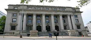
Schenectady County is a county located in the state of New York. Based on the 2010 census, the population was 154,727. The county seat is
Schenectady. The name is from a Mohawk language word meaning "on the other side of the pine lands," a term that originally applied to Albany.
Schenectady County is part of the Albany-Schenectady-Troy, NY Metropolitan Statistical Area, and is located west of the confluence of the
Mohawk with the Hudson River. It included territory on both the north and the south sides of the Mohawk River.
Etymology - Origin of Schenectady County Name
from a Mohawk Indian word meaning "on the other side of the pine lands"
Demographics:
County QuickFacts: CensusBureau Quick Facts
Schenectady County History
Schenectady County was formed from Albany County on March 7, 1809. It has a population of 146,555 (2000 U. S. Census,
twenty-second in New York State) and an area of 206 square miles, making it the second smallest in the state outside of
New York City. The name "Schenectady" is derived from a Mohawk Indian word for "on that side of the pinery," or "near
the pines," or "place beyond the pine plains."
Schenectady was known as the "city that lights and hauls the world" because of its prominent place in the locomotive
manufacturing industry and the presence of the headquarters of the General Electric Company.
It is no coincidence that Schenectady County is steeped in history which was vital to the funding and industrial
growth of New York State. It has been a county since 1809, chartered from a western portion of Albany County and
strategically located in the cradle of five mountain ranges - namely, the Adirondacks, the Catskills, the Helderbergs, the Green Mountains and the Berkshires. The easternmost settlement of the Mohawk Valley, Schenectady is
known as the "Gateway to the West."
Geography: Land and Water
Schenectady County is located in east central New York State, north of Albany.
As reported by the Census Bureau, the county has a total area of 543 km2 (210 sq mi). 534 km2 (206 sq mi) of it
is land and 9 km2 (4 sq mi) of it (1.68%) is water. Unlike many of the upstate New York counties, Schenectady County
is small in area.
Neighboring Counties
Bordering counties are as follows:
- Saratoga County, New York - east
- Albany County, New York - south
- Schoharie County, New York - southwest
- Montgomery County, New York - west
Education


Click Image to Enlarge
