


Click Image to Enlarge
New York Counties
There are sixty-two counties in the State of New York. The first twelve counties in New York were created immediately after the British annexation of the Dutch colony of New Amsterdam, although two of these counties have since been abolished. The most recent county formation in New York was in 1912, when Bronx County was created from the portions of New York City that had been annexed from Westchester County.Tioga County, New York
Tioga County Education, Geography, and History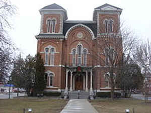
Tioga County is a county located in the state of New York. Based on the 2010 census, the population was 51,125. Its county seat is Owego.
Its name derives from an American Indian word meaning "at the forks", describing a meeting place.
Tioga County is part of the Binghamton, NY Metropolitan Statistical Area.
Etymology - Origin of Tioga County Name
from the Indian word meaning "at the forks," referring originally to a famous Indian meeting place
Demographics:
County QuickFacts: CensusBureau Quick Facts
Tioga County History
Tioga County, taken from Montgomery in 1794; bounds since much altered: still further reduced in 1836, bh the erection of Chemung County from its western portion. Greatest length E. and W. 31, greatest breadth N. and S. 29 miles. This, with Chemung county, is part of the broad and long belt extending westerly from Ulster and Greene counties to the vicinity of Lake Erie, preserving for a great part of the distance a mean height of about 1,600 feet above the level of the ocean. The soil of the county consists generally of sandy and gravelly loam, interspersed with patches of mud and clay. The uplands are commonly better adapted to grass than grain; but the valley gives fine crops of wheat and corn; oats, barley, peas, beans, and hops thrive almost everywhere. The Susquehannah is the principal stream in the county. The New York and Erie railroad crosses the county E. and W.; and the railroad from Owego to Ithaca N. and S. The county is divided into 9 towns. (Historical Collections of the State of New York, Past and Present, John Barber, Clark Albien & Co. 1851)
Tioga County is located in the south central part of New York State adjacent to the Pennsylvania border. Tioga
has been referred to as the "mother county"since the counties of Broome and Chemung, as well as parts of Tompkins,
Cortland and Chenango were formed from Tioga's original boundaries. The earliest traceable inhabitants of the county
were the Algonquin Indians, a primarily agricultural civilization that was later driven out by the Iroquois.
Geography: Land and Water
Tioga County is located in southwest New York State, west of Binghamton and directly north of the border with
Pennsylvania. The Susquehanna River flows into Pennsylvania from this county. The county is considered part of the
Southern Tier region of New York State.
The highest elevation is an unnamed 1,994-foot (607.8 m) hill in the county's northern corner.
As reported by the Census Bureau, the county has a total area of 523 square miles (1,354 km2), of which, 519
square miles (1,343 km2) of it is land and 4 square miles (11 km2) of it (0.81%) is water.
Neighboring Counties
Bordering counties are as follows:
- Cortland County, New York - northeast
- Broome County, New York - east
- Susquehanna County, Pennsylvania - southeast
- Bradford County, Pennsylvania - south
- Chemung County, New York - west
- Tompkins County, New York - northwest
Education


Click Image to Enlarge
