


Click Image to Enlarge
North Carolina Counties
North Carolina is divided into one hundred counties. The establishment of North Carolina counties stretches over 240 years, beginning in 1668 with the creation of Albemarle County and ending with the 1911 creation of Avery and Hoke counties. Five counties have been divided or abolished altogether, the last being Dobbs County in 1791.Alexander County, North Carolina
Alexander County Education, Geography, and History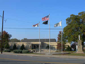
Alexander County is a county located in the state of North Carolina. Based on the 2010 census, the population was 37,198. Its county seat
is Taylorsville.
Alexander County is part of the Hickory-Lenoir-Morganton, NC Metropolitan Statistical Area.
Etymology - Origin of Alexander County Name
It was named in honor of William J. Alexander of Mecklenburg County, several times a member of the Legislature and speaker of the House of Commons.
Demographics:
County QuickFacts: CensusBureau Quick Facts
Alexander County History
Alexander was formed in 1847 from Iredell, Caldwell, and Wilkes counties. It was named in honor of William J. Alexander of Mecklenburg County, several times a member of the Legislature and speaker of the House of Commons. It is in the west central section of the State and is bounded by Iredell, Catawba, Caldwell, and Wilkes counties. The present land area is 260.18 square miles and the 2000 population was 33,603. The court was ordered to be held at James's Cross Roads until the county seat could be established. Commissioners were named to select a site for the county seat as near the center as possible, to acquire land, lay off the town of Taylorsville, and erect public buildings. Taylorsville is the county seat.
Geography: Land and Water
As reported by the Census Bureau, the county has a total area of 264 square miles (680 km2), of which 260 square miles (670 km2) is land
and 3.7 square miles (9.6 km2) (1.4%) is water.
Alexander County is located within the Piedmont region of western North Carolina. The county's main geographic feature is the Brushy
Mountains, a deeply eroded spur of the Blue Ridge Mountains to the west. The "Brushies," as they are called locally, rise from 300 to 1,000
feet (300 m) above the surrounding countryside, and dominate the county's northern horizon. The highest point in Alexander County is Hickory
Knob in the Brushies, it has an elevation of 2,560 feet (780 m) above sea level. Barrett Mountain, an isolated mountain ridge, is in the
western part of the county. The remainder of Alexander County's terrain consists of gently rolling countryside. The county's largest river,
the Catawba, forms its southern border.
Within Alexander County is the unincorporated town of Hiddenite, the location of a mine that yields emeralds, sapphires, and its namesake
stone "hiddenite," a variety of spodumene.
The county is served by US Highway 64, which is controlled access roadway connecting Taylorsville with Lenoir and Statesville. NC Highways 90,
16, and 127 also serve the county. Interstate 40 and 77 are just 30 minutes from the majority of county residents. The Charlotte Douglas
International Airport is an hour's drive from most parts of the county. The area is also served by the Hickory Regional Airport (30 minutes)
and the Statesville Airport (20 minutes). The Alexander Railroad Company is an active short line rail system operating between Taylorsville
and Statesville and connecting with Norfolk Southern.
Neighboring Counties
Bordering counties are as follows:
- Wilkes County, North Carolina - north
- Iredell County, North Carolina - east
- Catawba County, North Carolina - south
- Caldwell County, North Carolina - west
Education


Click Image to Enlarge
